Slovakia, officially known as the Slovak Republic, is a nation nestled in the heart of Europe. Often sparking the question “Where Is Slovakia?”, this landlocked country occupies a significant geographical position within Central Europe. Understanding Slovakia’s location is key to appreciating its rich history, diverse landscapes, and cultural significance.
Geographically, Slovakia is situated in Central Europe. It shares borders with several countries, further defining its location. To the north, it is bordered by Poland, to the east by Ukraine, to the south by Hungary, and to the southwest by Austria. Its western border is shared with the Czech Republic, its former federal partner. This central position has historically made Slovakia a crossroads of cultures and trade routes in Europe.
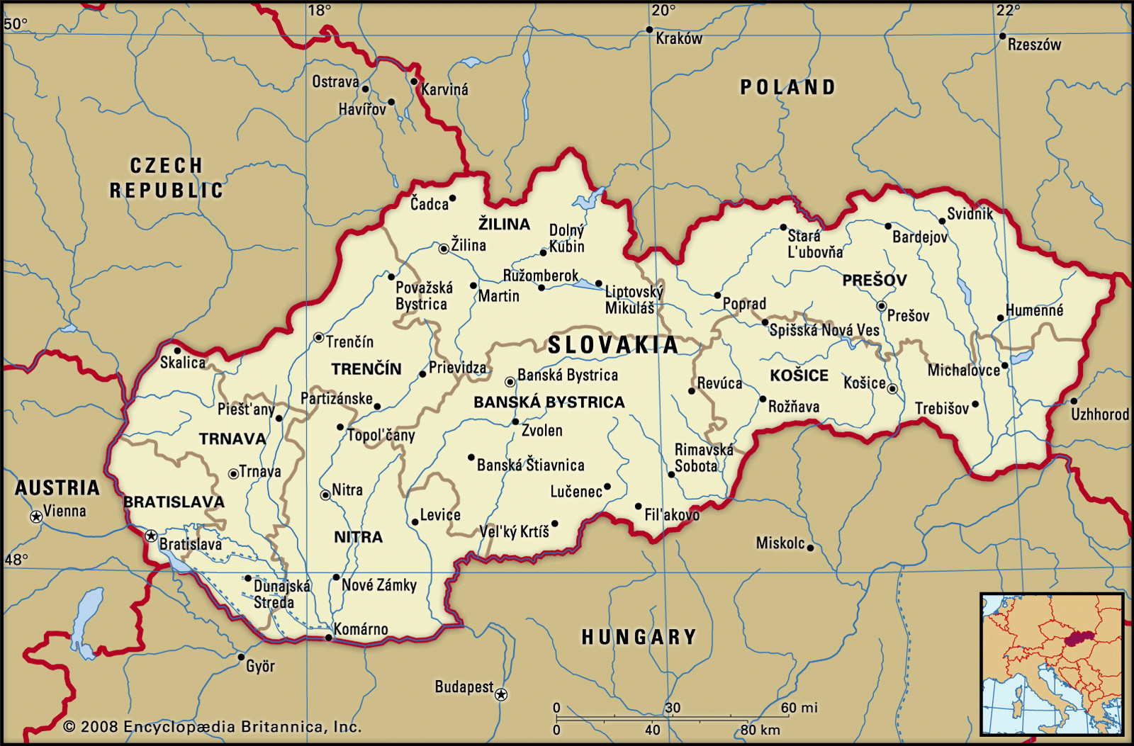 Map showing the location of Slovakia in Central Europe.
The landscape of Slovakia is predominantly shaped by the Western Carpathian Mountains, which dominate much of the country’s topography. These mountains run in an east-west direction and are divided into outer, central, and inner ranges, separated by valleys and basins. The most iconic mountain range is the High Tatra Mountains, part of the Central Western Carpathians, located in the northern part of Slovakia on the border with Poland. It is within the High Tatras that you’ll find Gerlachovský Peak, the highest point in Slovakia, reaching an elevation of 8,711 feet (2,655 meters). South of the High Tatras are the Low Tatra Mountains, another significant range reaching heights of around 6,500 feet (2,000 meters). These mountain regions contribute to Slovakia’s stunning natural beauty and offer opportunities for outdoor activities like hiking and skiing.
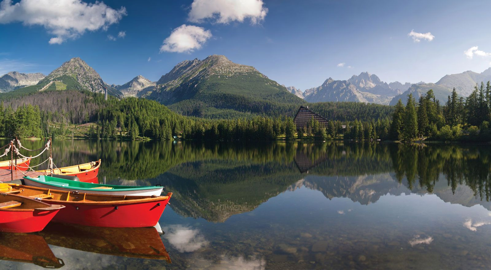 Scenic view of Štrbské Pleso lake in the High Tatra Mountains of Slovakia.
In contrast to the mountainous regions, Slovakia also features lowland areas. The Little Alfold, also known as the Danubian Lowland, is located in the southwest, bordering Hungary and Austria. In the eastern part of the country, the Eastern Slovakian Lowland stretches towards Ukraine. These lowlands are part of the broader Inner Carpathian Depressions region and are characterized by fertile lands suitable for agriculture.
Slovakia’s drainage system is primarily directed southward into the Danube River system. The Danube River itself forms a part of Slovakia’s southwestern border, along with the Morava River. Major rivers flowing through Slovakia include the Váh, Hron, Hornád, and Bodrog, all of which flow in a southerly direction. The Poprad River is a notable exception, draining northward. The presence of numerous rivers, mountain lakes, and mineral springs adds to the country’s rich natural resources.
Historically, Slovakia’s identity has been intertwined with its geographical location. For centuries, from the 11th century onwards, the territory of present-day Slovakia was part of the Kingdom of Hungary, known as Upper Hungary or “the Highlands”. Despite Hungarian influence, a distinct Slovak identity gradually emerged. In the 20th century, after World War I and the dissolution of Austria-Hungary, Slovakia became part of Czechoslovakia in 1918. Slovakia achieved full sovereignty as an independent nation on January 1, 1993, following the peaceful dissolution of Czechoslovakia, known as the Velvet Divorce.
Slovakia’s capital city, Bratislava, is uniquely situated in the extreme southwest of the country, close to the borders with Austria and Hungary. Historically known by various names like Pozsony (Hungarian), Pressburg (German), and Prešporok (Slovak), Bratislava served as the capital of Hungary for three centuries. Košice, the second-largest city, is located in eastern Slovakia and blends medieval history with more recent industrial heritage.
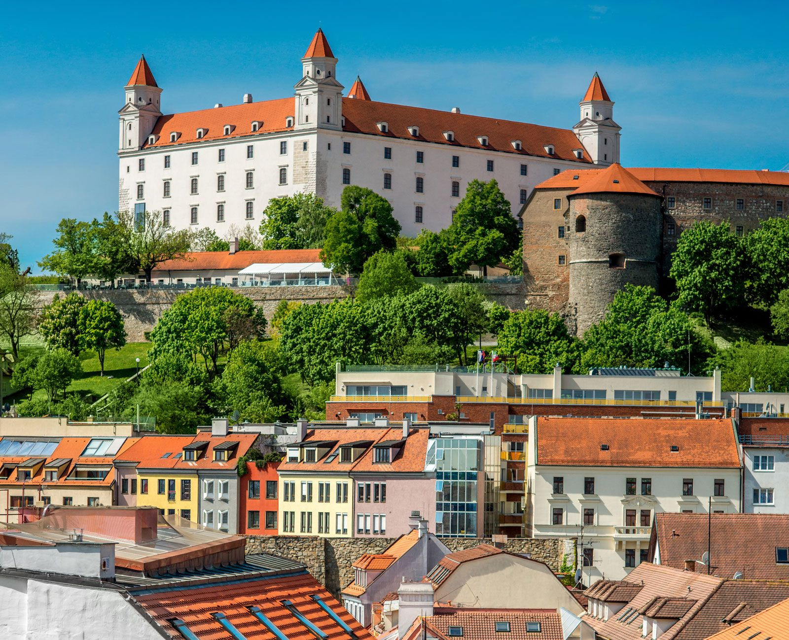 Bratislava Castle overlooking the Old Town, the capital city of Slovakia.
In conclusion, Slovakia is geographically positioned in Central Europe, bordered by several nations that have influenced its history and culture. Its landscape is defined by the Carpathian Mountains and lowland plains, with a network of rivers and natural springs. Understanding “where is Slovakia” not only pinpoints its location on a map but also opens a gateway to discovering its rich geographical diversity and historical depth within the European continent.