
Norway, a land of breathtaking fjords, majestic mountains, and the mesmerizing Northern Lights, is a country that captures the imagination of travelers and geography enthusiasts alike. But Where Is Norway Located exactly? Nestled in Northern Europe, Norway occupies the western and northernmost portion of the Scandinavian Peninsula. Its geographical position is key to understanding its unique landscape, climate, and culture.
Geographic Location and Key Features of Norway
Norway’s location is strategically significant, bordering Sweden, Finland, and Russia to the east, and facing the vast expanse of the Atlantic Ocean to the west and north. To its south lies the Skagerrak strait, leading to the North Sea and Denmark. This placement on the Scandinavian Peninsula is fundamental to Norway’s identity as a Nordic country.
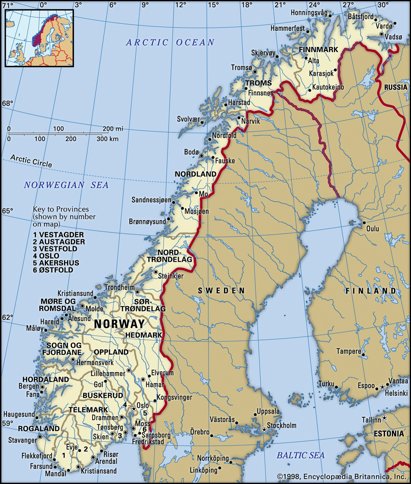 Location of Norway in Europe: Map showing Norway's position in Northern Europe, highlighting its Scandinavian Peninsula location and neighboring countries Sweden, Finland, and Russia.
The country’s coastline is exceptionally long and indented, stretching for thousands of kilometers. This is largely due to the iconic fjords – deep, narrow inlets carved by glaciers during the Ice Age. These dramatic geological features are a defining characteristic of western Norway, creating a stunningly beautiful and rugged landscape. Off the coast, a multitude of islands, estimated at around 50,000, further contribute to the complex geography of Norway.
Inland, Norway is predominantly mountainous. Two-thirds of the country is covered by mountains, which significantly impacts settlement patterns, infrastructure, and even the climate. The mountainous terrain acts as a spine down the country, influencing weather systems and creating distinct regional variations. Despite its northerly latitude, the Norwegian Sea and the North Atlantic Current, an extension of the Gulf Stream, moderate the climate, especially along the coast, making it milder than other regions at similar latitudes.
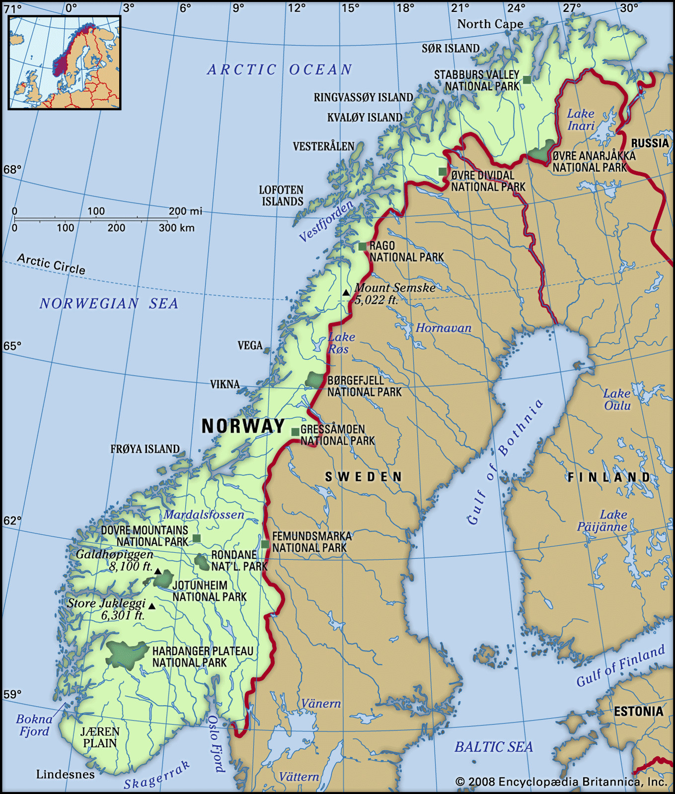 Norway's terrain: Physical map illustrating the mountainous landscape of Norway, emphasizing the Lang Mountains and major geographical features like the Hardanger Plateau.
Regions of Norway: North to South
Norway can be broadly divided into four traditional regions, reflecting geographical and cultural differences:
- Southern Norway (Sørlandet): Although not explicitly mentioned in the original text as a traditional region, for completeness and modern understanding of Norway’s regions, it’s worth noting Sørlandet or Southern Norway, the southernmost part, known for its coast and milder climate.
- Eastern Norway (Østlandet): This region, surrounding Oslo, is the most populous and includes the capital city. It’s characterized by broader valleys and forests compared to the west.
- Western Norway (Vestlandet): Famous for its fjords and dramatic coastal scenery, including cities like Bergen and Stavanger. This region is heavily influenced by the sea.
- Trondheim Region (Trøndelag): Located in the central part of Norway, named after the city of Trondheim, historically significant and geographically diverse.
- Northern Norway (Nord-Norge): Extending far into the Arctic Circle, this region is known for its Arctic landscapes, the midnight sun in summer, and the polar night in winter. It’s home to the indigenous Sami people.
These regions highlight the diverse geography within Norway, all stemming from its location on the Scandinavian Peninsula and its unique geological history.
Historical and Cultural Context of Norway’s Location
Norway’s location has profoundly shaped its history and culture. Its extensive coastline and proximity to the sea fostered a strong maritime tradition. The Viking Age, a period of Norse exploration and expansion, originated from this seafaring heritage. Norwegian Vikings, or Norsemen, navigated across vast oceans, reaching as far as North America centuries before Columbus.
Throughout history, Norway’s northern location and relatively isolated position contributed to a strong sense of homogeneity and independence. While influenced by neighboring Denmark and Sweden for periods, Norway ultimately asserted its independence in 1905.
In modern times, Norway’s geographical position has continued to be a major asset. The discovery of offshore oil and natural gas in the North Sea in the late 20th century transformed the Norwegian economy, making it one of the wealthiest nations in the world. Its location in the Arctic is also becoming increasingly significant in terms of resource access, shipping routes, and geopolitical considerations.
Why Norway’s Location Matters: Climate, Economy, and Strategy
Norway’s geographical location is not just a matter of coordinates; it’s a defining factor in several key aspects:
- Climate: Despite its high latitude, Norway enjoys a relatively mild climate compared to other regions at similar latitudes, particularly along the coast. The North Atlantic Current warms the coastal areas, allowing for ice-free ports year-round and supporting diverse marine life. However, inland and northern regions experience colder, more continental climates. The Northern Lights, or Aurora Borealis, a spectacular natural phenomenon, are visible in Northern Norway due to its proximity to the Arctic Circle.
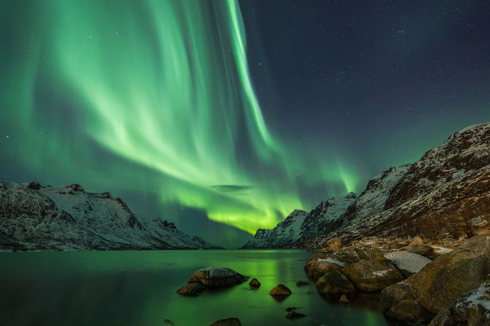 Northern Lights in Norway: Image showcasing the Northern Lights over a Norwegian landscape, emphasizing the country's location in the Arctic region.
-
Economy: Historically reliant on fishing and maritime trade, Norway’s economy has diversified to include shipping, shipbuilding, and most significantly, petroleum exports. Its location on the North Sea made it a major player in the global energy market. Fishing remains a crucial industry, and Norway’s fjords and coastal waters are rich in marine resources.
-
Strategic Importance: Norway’s location in Northern Europe and its long coastline facing the Atlantic and Arctic Oceans give it strategic importance. As a NATO member, it plays a role in regional security and monitoring activities in the North Atlantic and Arctic.
Conclusion: Norway’s Unique Place in the World
So, where is Norway located? It’s situated in Northern Europe, on the western side of the Scandinavian Peninsula. This location is not just a point on a map; it’s the foundation of Norway’s stunning natural beauty, unique culture, and significant role in the world. From the Viking explorers who sailed from its fjords to the modern-day prosperity fueled by its North Sea resources, Norway’s geography has been and continues to be its defining characteristic. Understanding Norway’s location is the first step to appreciating this remarkable Nordic nation.