
Serbia, often recognized for its rich history and vibrant culture, is a nation situated at the crossroads of Central and Southeast Europe. But where is Serbia exactly? This landlocked country lies in the west-central Balkans and for much of the 20th century, it formed a significant part of Yugoslavia. To truly understand Serbia, we need to delve into its geographical location, its historical context, and what makes it a unique destination in Europe.
 Serbia in Balkan Peninsula and Yugoslavia
Delving into Serbia’s Location
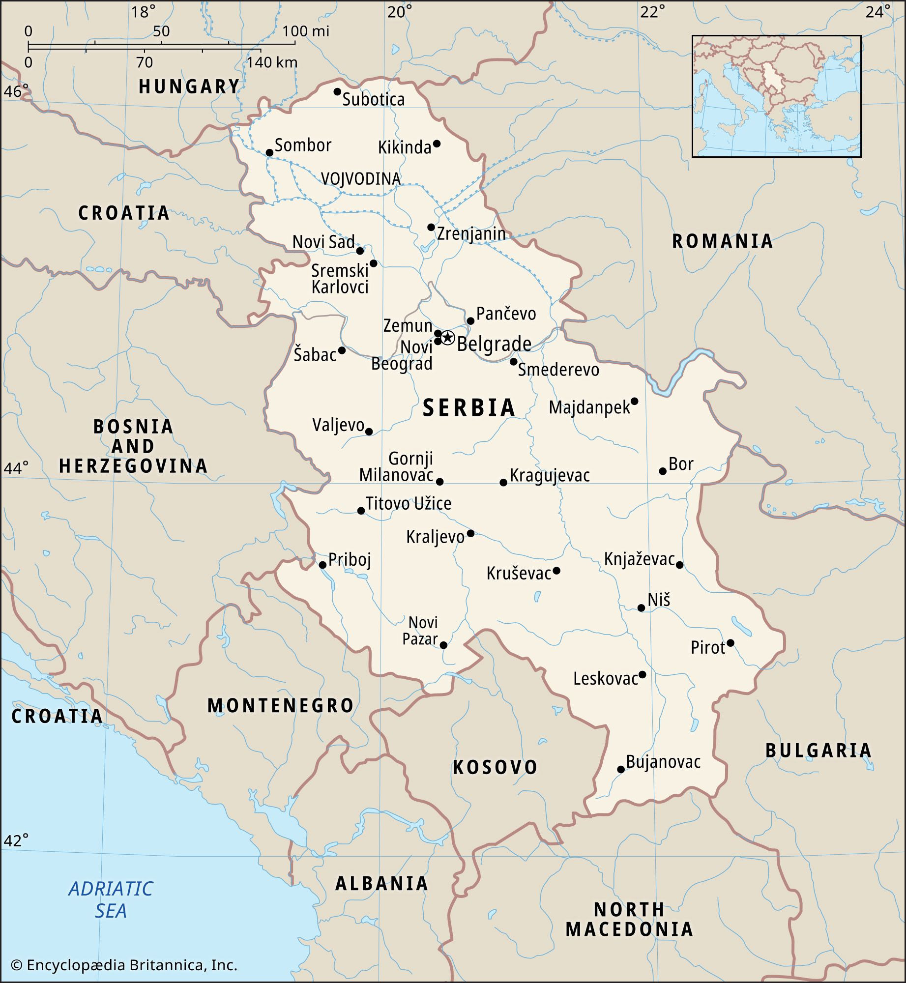
Geographically, Serbia is nestled in a strategic location, bordering several countries. To its west, you’ll find Bosnia and Herzegovina and Croatia. Hungary lies to the north, while Romania and Bulgaria mark its eastern borders. To the south, Serbia is bordered by North Macedonia, and to the southwest by Montenegro. It’s also important to note the proximity of Kosovo to the south, a region whose status is a matter of ongoing dispute and is not recognized as independent by Serbia. This positioning places Serbia firmly within the Balkan Peninsula, a region known for its diverse landscapes, cultures, and complex history.
A world locator map pinpointing Serbia’s geographical position in Europe.
Serbia’s capital city, Belgrade (Beograd), further clarifies its location. Belgrade is a prominent European city located at the confluence of two major rivers, the Danube and the Sava. This strategic point has historically made Belgrade a crucial hub for trade and cultural exchange. The city itself is cosmopolitan, boasting a blend of historical charm and modern development. Its Stari Grad, or Old Town, is famous for the Kalemegdan Fortress, a testament to centuries of history, alongside well-preserved medieval architecture and a thriving restaurant scene reflecting Eastern European culinary traditions. Novi Sad, Serbia’s second-largest city, sits upstream along the Danube, serving as a cultural and educational center, often compared to the university towns of neighboring Hungary.
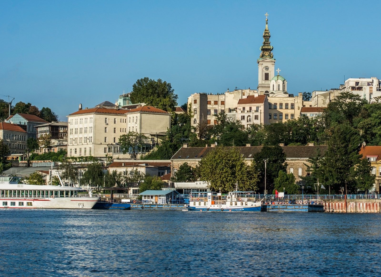 Boats on Danube and Sava River in Belgrade Serbia
Serbia’s Place in History: Yugoslavia and Beyond
To fully grasp where Serbia is situated in the modern world, understanding its historical context is essential. For much of the 20th century, Serbia was a central republic within Yugoslavia, a nation formed after World War I from a collection of South Slavic territories. Yugoslavia encompassed not only modern-day Serbia but also Croatia, Slovenia, Bosnia and Herzegovina, Kosovo, North Macedonia, and Montenegro. This federation was an attempt to unite diverse ethnicities and cultures under a single banner.
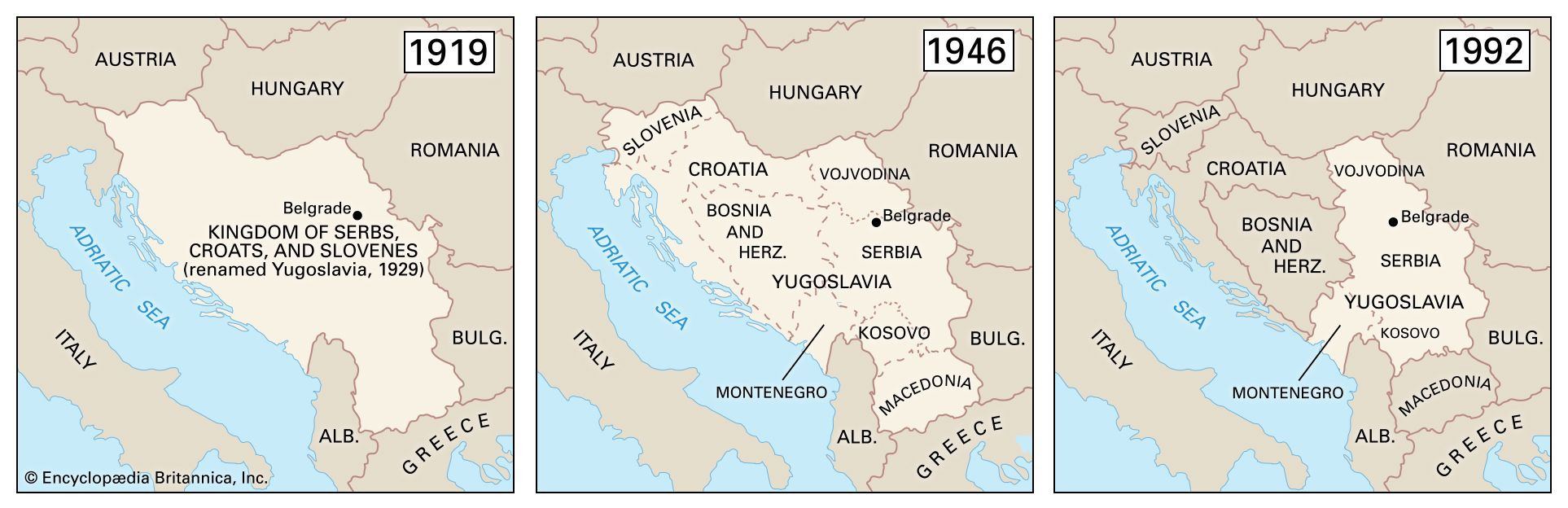 Map of Yugoslavia 1919-1992 Boundaries
Serbia’s historical lands were previously under the control of both the Ottoman Empire and Austria-Hungary for extended periods. In 1918, these regions, alongside others, merged to create the Kingdom of Serbs, Croats, and Slovenes, which later became Yugoslavia in 1929. Serbia held a dominant role within this union. After World War II, under Josip Broz Tito’s communist leadership, Yugoslavia adopted a non-aligned stance during the Cold War, granting some autonomy to its constituent republics while attempting to balance ethnic interests within the federal administration.
However, the death of Tito in 1980 and the subsequent fall of communism in Eastern Europe unleashed resurgent nationalism, fracturing Yugoslav unity. Slobodan Milošević, a Serbian leader, sought to create a “Greater Serbia,” but his policies ultimately led to the secession of Slovenia, Croatia, Bosnia and Herzegovina, and Macedonia in the early 1990s, accompanied by devastating civil wars. Later in the 1990s, conflict erupted in Kosovo, leading to NATO intervention and a period of UN administration. Eventually, in 2006, Montenegro and Serbia dissolved their loose federation, becoming independent nations. Kosovo declared independence in 2008, further reshaping the region.
The Diverse Landscapes of Serbia
The Serbian landscape is as diverse as its history. The northern region of Vojvodina is characterized by flat plains, part of the Pannonian Basin, with elevations generally between 200 and 350 feet above sea level. The Fruška Gora hills offer a gentle interruption to these plains, rising to about 1,765 feet. Central Serbia is more hilly and mountainous, forming the heart of the country. Western Serbia includes parts of the Dinaric Alps, while eastern Serbia extends into the Carpathian and Rhodope mountain systems. The Šumadija hills, historically significant as the core of medieval Serbia, are located in the central region.
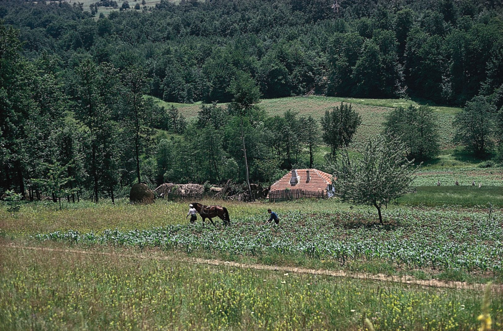 Corn Fields in Šumadija Serbia
The Kopaonik Mountains in southwestern Serbia are known for their granite ridge and reach heights of 6,617 feet, a tectonically active zone prone to earthquakes. In eastern Serbia, the Balkan Mountains along the Bulgarian border reach even higher elevations, exceeding 7,000 feet. The dramatic Iron Gate gorge of the Danube River forms part of Serbia’s northeastern border with Romania, a remarkable natural feature where the river carves through the Carpathian Mountains.
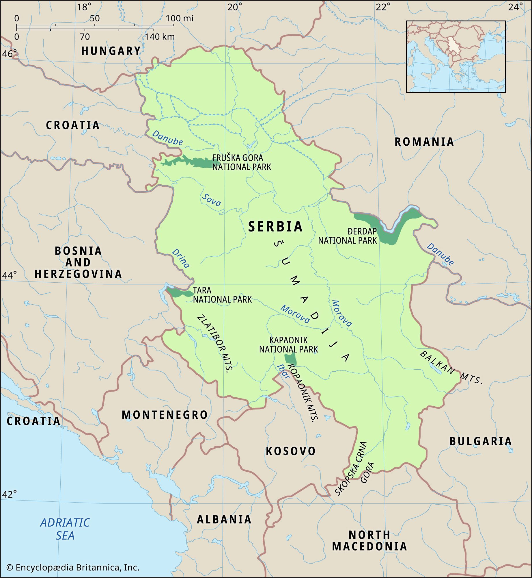 Serbia Physical Map
In conclusion, Serbia is located in Southeast Europe, in the Balkan Peninsula. It’s a landlocked nation with a rich tapestry of history, culture, and diverse landscapes ranging from fertile plains to rolling hills and imposing mountains. Understanding where Serbia is situated geographically and historically provides crucial context for appreciating its role in the Balkans and Europe as a whole.