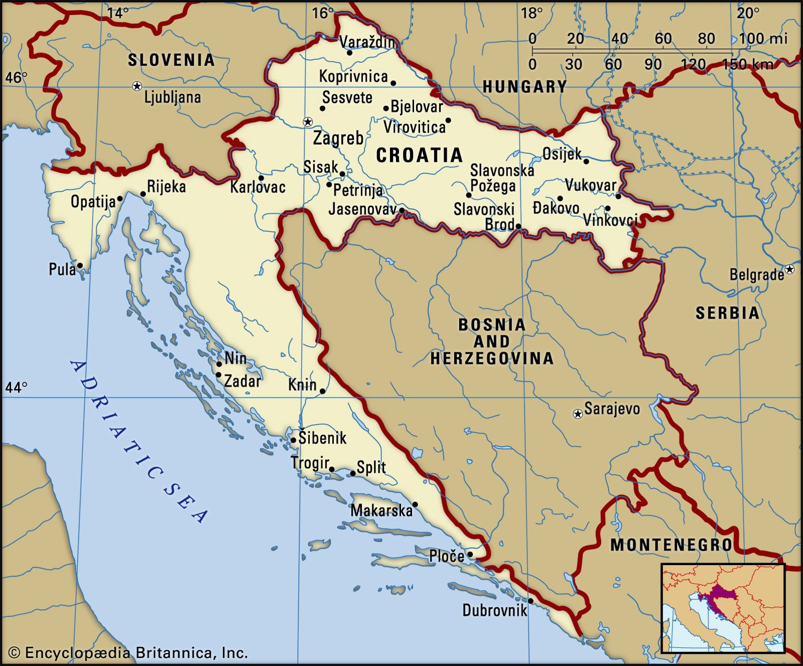
Croatia, officially known as the Republic of Croatia (Republika Hrvatska), is situated in a geographically diverse and strategically important part of Europe. To answer the fundamental question, Where Is Croatia Country?, it is located in Northwestern part of the Balkan Peninsula and Southeastern Europe. This crescent-shaped nation boasts a unique blend of Central European and Mediterranean influences, making it a captivating destination for travelers and a subject of interest for geographers and historians alike.
 Map of Croatia in Europe, highlighting its location in the Balkan Peninsula and Southeastern Europe
Croatia is a country of contrasts, from its mainland regions bordering Central Europe to its stunning Adriatic coastline dotted with over a thousand islands. Its capital city, Zagreb, is nestled in the continental north, while its coastal cities like Dubrovnik and Split have become world-renowned for their beauty and historical significance along the Adriatic Sea.
To understand Croatia’s location more deeply, it’s essential to consider its borders and the regions it encompasses. Croatia shares borders with:
- Slovenia and Hungary to the north.
- Serbia to the east, specifically the Vojvodina region.
- Bosnia and Herzegovina and Montenegro to the south.
- The Adriatic Sea forms its western and southwestern border, providing Croatia with a long and picturesque coastline.
This positioning places Croatia at a crossroads of cultures and geographical zones. It acts as a bridge between the Mediterranean, Central Europe, and the Balkans, influencing its history, culture, and landscape.
Delving into Croatia’s Geographical Regions
Croatia’s geography can be broadly divided into three main regions, each contributing to the country’s diverse character:
- The Pannonian and Para-Pannonian Plains: Located in the north and northeast, forming the upper arm of Croatia’s crescent shape, this region is characterized by flatlands and fertile agricultural areas. The plains are shaped by the Sava and Drava rivers, making it Croatia’s breadbasket. Cities like Osijek and Vukovar are located in this eastern part of Croatia.
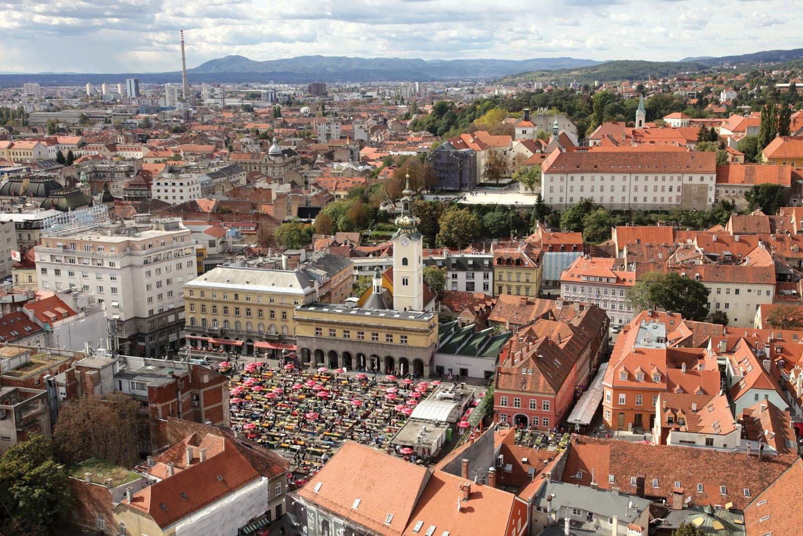 Aerial view of Zagreb, the capital city of Croatia, showcasing urban landscape in the continental region
- The Central Mountain Belt (Dinaric Alps): Stretching west and south of the Pannonian region, this mountainous area connects inland Croatia with the Adriatic coast. Part of the Dinaric Alps, this region features karst plateaus, forests, and the highest peak of Croatia, Dinara mountain. This area is less densely populated but crucial for its natural resources and biodiversity.
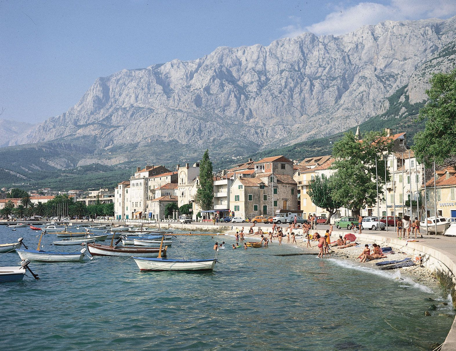 Landscape of Dinaric Alps rising from the Dalmatian Coast near Makarska, Croatia, showcasing mountainous terrain meeting the Adriatic Sea
- The Croatian Littoral (Adriatic Coast): This region encompasses the Istrian Peninsula in the north and the Dalmatian coast extending southward. Wedged between the Dinaric Alps and the Adriatic Sea, it’s famous for its stunning coastline, numerous islands, and Mediterranean climate. Major coastal cities include Rijeka, Split, and Dubrovnik.
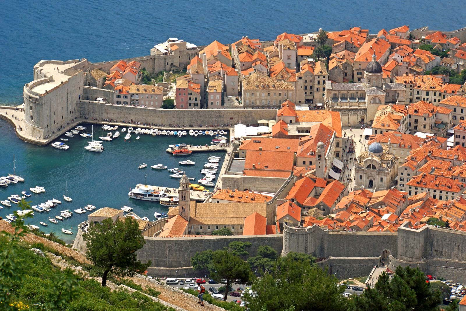 Panoramic view of Dubrovnik, Croatia, walled city on the Adriatic Sea, illustrating coastal beauty and historical architecture
The Croatian littoral is further characterized by over 1,100 islands and islets, ranging from small, uninhabited rocks to larger islands like Krk, Cres, and Hvar, popular for tourism and known for their unique cultures and landscapes.
Key Geographical Features
Understanding where Croatia country is also involves recognizing its key geographical features:
- Rivers: The Sava and Drava rivers are crucial waterways, flowing through the Pannonian plains and providing fertile soil. They, along with the Danube, also form natural borders with neighboring countries. Coastal rivers like Krka and Cetina are important for hydroelectric power and their flow into the Adriatic.
- Coastline: Croatia’s Adriatic coastline is one of its most defining features, known for its clear waters, numerous islands, and historical port cities.
- Mountains: The Dinaric Alps play a significant role in Croatia’s landscape and climate, separating the coastal Mediterranean region from the continental inland.
Climate and Natural Environment
Croatia’s location results in diverse climates. The inland regions experience a continental climate with warm summers and cold winters, while the coastal areas enjoy a Mediterranean climate characterized by mild, wet winters and hot, dry summers. This climate diversity supports a rich variety of plant and animal life, from forests and plains inland to Mediterranean vegetation and marine life along the coast.
Croatia is home to several national parks and nature reserves, protecting its diverse ecosystems and landscapes. Plitvice Lakes National Park and Krka National Park are famous for their stunning waterfalls and natural beauty, attracting visitors from around the globe.
Croatia in the European and Global Context
Croatia’s entry into the European Union in 2013 and the adoption of the Euro as its currency in 2023 have further solidified its position as a European nation. Its geographical location makes it a significant transit country and a bridge between different parts of Europe.
In conclusion, when asking “where is Croatia country?”, the answer is multifaceted. Croatia is strategically located in Southeastern Europe, in the northwestern Balkans, bordering several countries and boasting a long Adriatic coastline. Its diverse geographical regions, from continental plains to mountainous areas and a stunning coast, contribute to its unique identity and make it a country of significant geographical and cultural interest. Whether you are interested in its historical cities, natural landscapes, or its place in Europe, understanding Croatia’s location is the first step to appreciating all it has to offer.