Kenya, a country synonymous with breathtaking safaris and vibrant cultures, often sparks the fundamental question: “Kenya, where is it?”. Nestled in East Africa, Kenya straddles the Equator, offering a diverse tapestry of landscapes from its Indian Ocean coastline to its towering mountains and vast savannas. This article delves into the geographical intricacies of Kenya, painting a vivid picture of its location and its captivating physical features.
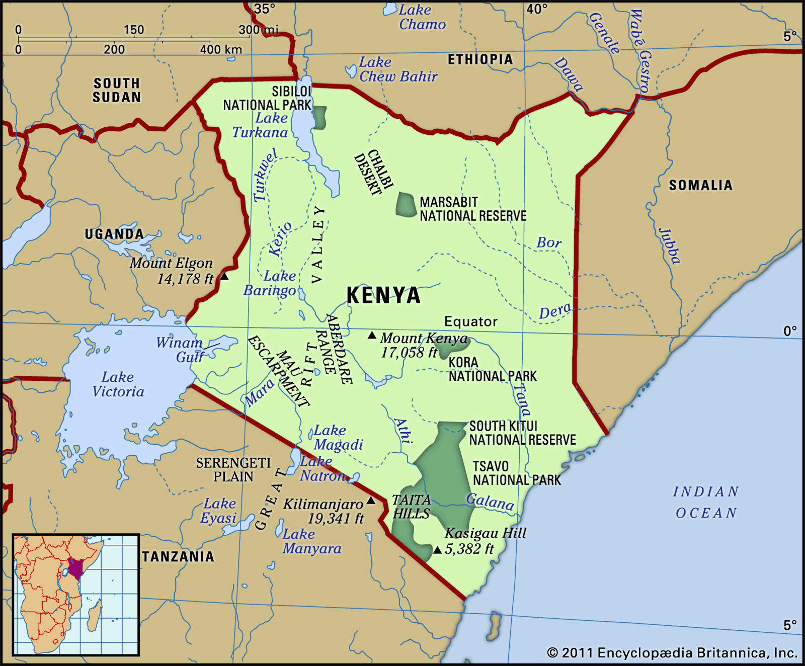
Kenya Physical Features Map: A detailed view of Kenya’s diverse geographical landscape, highlighting key regions and their locations.
Kenya’s precise coordinates place it in Eastern Africa, bisected by the Equator and the 38th meridian east. It shares borders with several nations, further defining its location. To the north, Kenya is bounded by South Sudan and Ethiopia, while Somalia and the Indian Ocean lie to its east. Tanzania forms its southern border, and to the west, Lake Victoria and Uganda complete the geographical frame. This strategic location in East Africa positions Kenya as a crucial hub in the region.
Diverse Relief: From Coastal Plains to the Great Rift Valley
The 38th meridian, cutting through Kenya, essentially divides the country into two contrasting halves in terms of relief. East of this line, the terrain gently slopes towards the Indian Ocean, characterized by coastal plains and coral reefs. In contrast, western Kenya rises dramatically, transitioning through hills and plateaus towards the Eastern Rift Valley, known locally as the Central Rift Valley. Further west, the land descends again into a plateau, culminating in the Lake Victoria basin. Kenya’s geography can be broadly categorized into five principal regions: the Lake Victoria basin, the Rift Valley and its highlands, the eastern plateau forelands, the arid north and south, and the coastal strip.
The Lake Victoria basin, part of a larger plateau extending eastward from the lake, sits at an elevation between 3,000 and 4,000 feet above sea level. This region is characterized by rolling grasslands, bisected by the Kano Plain, where the Winam Gulf (formerly Kavirondo Gulf), an arm of Lake Victoria, extends inland. Extinct volcanoes dot the highlands surrounding the Kano Plain, including Mount Elgon, which marks the Ugandan border and reaches a height of 14,178 feet.
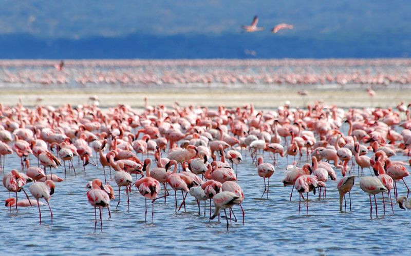
Lake Nakuru Flamingos: A view of Lake Nakuru, a soda lake within the Kenyan Rift Valley, famous for its large flamingo population, illustrating the unique ecosystems within Kenya’s diverse landscape.
The Rift Valley carves through the highlands, creating a dramatic geological feature that splits the region into the Mau Escarpment to the west and the Aberdare Range to the east. The valley’s width varies from 30 to 80 miles, and its floor elevation changes significantly, from 1,500 feet in the north near Lake Turkana (Lake Rudolf) to over 7,000 feet at Lake Naivasha, before dropping again towards the Tanzanian border. A chain of shallow lakes, including Lake Naivasha, Magadi, Nakuru, Bogoria, and Baringo, occupy the valley floor, interspersed with extinct volcanoes. West of the Rift, the highlands extend to the Uasin Gishu Plateau, while to the east, the Aberdare Range rises to almost 10,000 feet. The eastern highlands continue towards Mount Kenya, the country’s highest peak at 17,058 feet, playing a crucial role in Kenya’s history and economy, and attracting significant European settlement in the past.
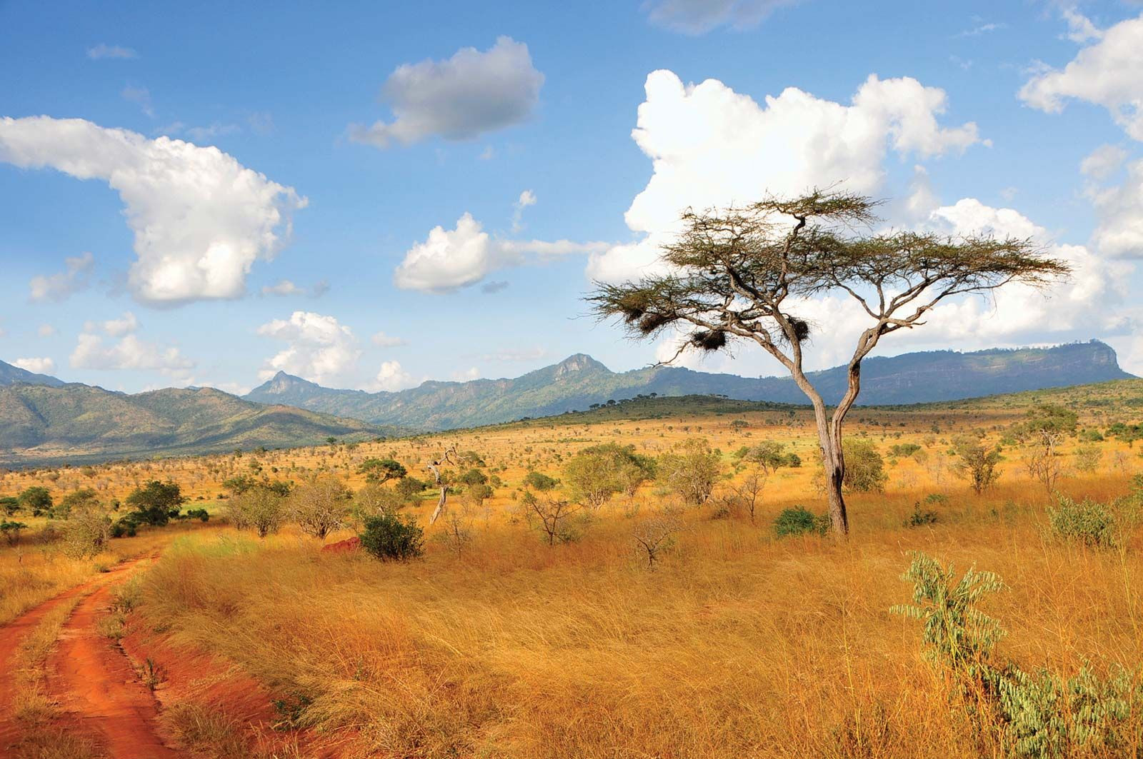
Acacia Trees in Taita Hills, Kenya: A scenic shot of acacia trees dotting the landscape of Taita Hills, showcasing the typical vegetation of the eastern plateau forelands of Kenya.
East of the Rift highlands lie the eastern plateau forelands, a vast plateau of ancient rocks sloping towards the coast. This region is marked by scattered hills and elevated formations like the Taita, Kasigau, Machakos, and Kitui hills, which benefit from more favorable climates compared to the famine-prone surrounding areas.
The northern and northeastern parts of Kenya are characterized by semiarid and arid conditions, extending from the Ugandan border to the Ethiopian highlands. True desert areas are limited, such as the Chalbi Desert east of Lake Rudolf. Water scarcity significantly dictates human and livestock movement in these regions.
Kenya’s coastal plain along the Indian Ocean stretches for about 250 miles. It is narrow in the south, around 10 miles wide, but broadens to approximately 100 miles in the Tana River lowlands to the north, merging into the Somali lowlands further northeast. Mombasa boasts excellent natural harbors, among the best in East Africa, highlighting the coastal region’s strategic importance.
Drainage and Soil Diversity
Kenya’s drainage system is a legacy of a large geological dome that formed the Central Rift Valley, creating a primeval watershed. Rivers like the Tana and Galana still follow the ancient pattern, flowing eastward to the Indian Ocean from the eastern highlands. West of the Rift Valley, rivers such as the Nzoia, Yala, Mara, and Nyando now drain into Lake Victoria. The Rift Valley’s formation has led to a complex network of internal streams feeding the major lakes within it.
While groundwater basins are not significant, Lake Victoria stands out as Africa’s largest lake and the second-largest freshwater body globally, serving as a major Nile River reservoir. Lake Turkana, another significant lake, dominates the Rift Valley lakes in size. Other lakes are smaller with fluctuating surface areas.
Soil composition in Kenya is as diverse as its landscape. Fertile sandy loam soils, derived from lava deposits, are found in the Lake Victoria basin, particularly around Winam Bay. Mount Elgon’s volcanic soils are renowned for coffee and tea cultivation. The Rift Valley and highlands feature fertile dark brown loams on younger volcanic deposits. However, sandy soils prevail in the semiarid regions between the coast and the Rift highlands, and red desert soils cover vast areas north of the Rift. Soil erosion is a widespread issue, exacerbated by deforestation, overgrazing, and cultivation, especially in arid and semiarid zones.
In conclusion, when considering “Kenya Where Is It?”, the answer is multifaceted. Kenya is strategically located in East Africa, straddling the Equator, with a rich tapestry of geographical features ranging from fertile lake basins and dramatic rift valleys to arid plains and a vibrant coastline. This geographical diversity not only defines Kenya’s landscape but also profoundly influences its climate, agriculture, and cultural diversity, making it a truly unique and captivating country.


 flamingos in Lake Nakuru
 Taita Hills