Tanzania, officially the United Republic of Tanzania, is a captivating East African nation renowned for its vast wilderness areas. But where is Tanzania located exactly? To pinpoint Tanzania, envision the eastern side of Africa, bordering the Indian Ocean. It’s nestled just south of the equator, within the African Great Lakes region. Mainland Tanzania is bordered to the north by Uganda, Lake Victoria, and Kenya; to the east by the Indian Ocean; to the south and southwest by Mozambique, Lake Nyasa, Malawi, and Zambia; and to the west by Lake Tanganyika, Burundi, and Rwanda. This strategic location places Tanzania at a fascinating crossroads of diverse ecosystems and cultures.
Quick Facts about Tanzania:
| Fact | Detail |
|---|---|
| Head of State | President Samia Suluhu Hassan |
| Capital | Dodoma |
| Estimated Population (2025) | 67,529,000 |
| Government Type | Unitary multiparty republic |
| Official Languages | Swahili, English |
| Land Area | 945,500 sq km (365,058 sq mi) |
| Currency | Tanzanian Shilling (TZS) |
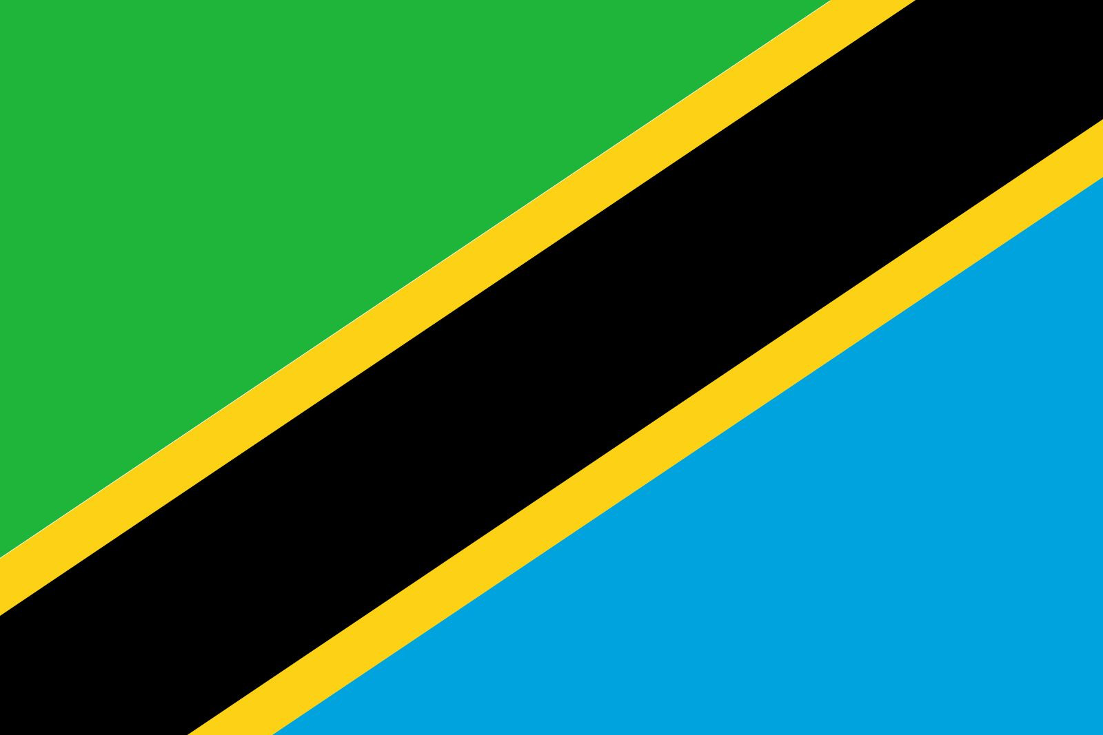
The national flag of Tanzania, symbolizing the unity and resources of the country.
Tanzania’s Diverse Relief and Landscape
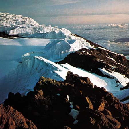
Beyond simply stating where Tanzania is, understanding its physical geography is crucial to appreciate its unique character. Except for a narrow coastal strip and offshore islands, the majority of Tanzania sits at an elevation above 600 feet (200 meters). The landscape is a dramatic tapestry of expansive plains, towering plateaus, and spectacular geological formations. Dominating the skyline is Mount Kilimanjaro, Africa’s highest peak, soaring to 19,340 feet (5,895 meters). In stark contrast, Lake Tanganyika plunges to depths of 4,710 feet (1,436 meters), making it the second deepest lake globally.
A map illustrating the diverse physical features of Tanzania, including its lakes, mountains, and plateaus.
The Great East African Rift System dramatically shapes Tanzania’s geography. This rift system, a zone of geological fractures, carves through the country in two primary north-south branches. These rifts have created deep, narrow valleys often filled by sizable lakes. The Western Rift Valley, defining Tanzania’s western border, cradles Lake Tanganyika and Lake Rukwa. Meanwhile, the Eastern Rift Valley, also known as the Great Rift Valley, cuts through central Tanzania from the Kenyan border near Lakes Eyasi, Manyara, and Natron, extending southward to Lake Nyasa at the Mozambican border. Between these two rift branches lies the vast central plateau, encompassing over a third of Tanzania’s landmass.
The majestic Mount Kilimanjaro, Africa’s highest peak, standing as a prominent feature of Tanzania’s landscape.
Highlands are prominent features associated with the Western Rift Valley, including the Ufipa Plateau, the Mbeya Range, and the Rungwe Mountain in the southwest. The southern highlands then stretch northeast towards the Ukuguru and Nguru mountains, northwest of Morogoro. Extending from the northern coast, the Usambara and Pare mountain ranges run southeast to northwest, culminating in the snow-capped Kilimanjaro and continuing to Mount Meru (14,978 feet [4,565 meters]). West of Mount Meru, another mountain chain includes the active volcano Ol Doinyo Lengai and the Ngorongoro Crater, the world’s largest caldera. This chain stretches through a corridor between Lakes Eyasi and Manyara towards Dodoma, further illustrating the varied topography within Tanzania’s location.
Ol Doinyo Lengai, an active volcano near Lake Natron, showcasing Tanzania’s volcanic activity.
Drainage Systems and Water Bodies in Tanzania
Tanzania’s landscape is generously dotted with water bodies. Approximately 22,800 square miles (59,000 square km) of its territory is covered by inland water. Lake Victoria, the second-largest freshwater lake in the world, is a significant feature, although it is not part of the Rift System itself. Interestingly, despite lacking major rivers within its boundaries, Tanzania acts as a hydrological apex. It is the source of three of Africa’s great rivers: the Nile, the Congo, and the Zambezi. These rivers flow to the Mediterranean Sea, the Atlantic Ocean, and the Indian Ocean, respectively, originating from the Tanzanian plateau but diverging into separate watersheds.
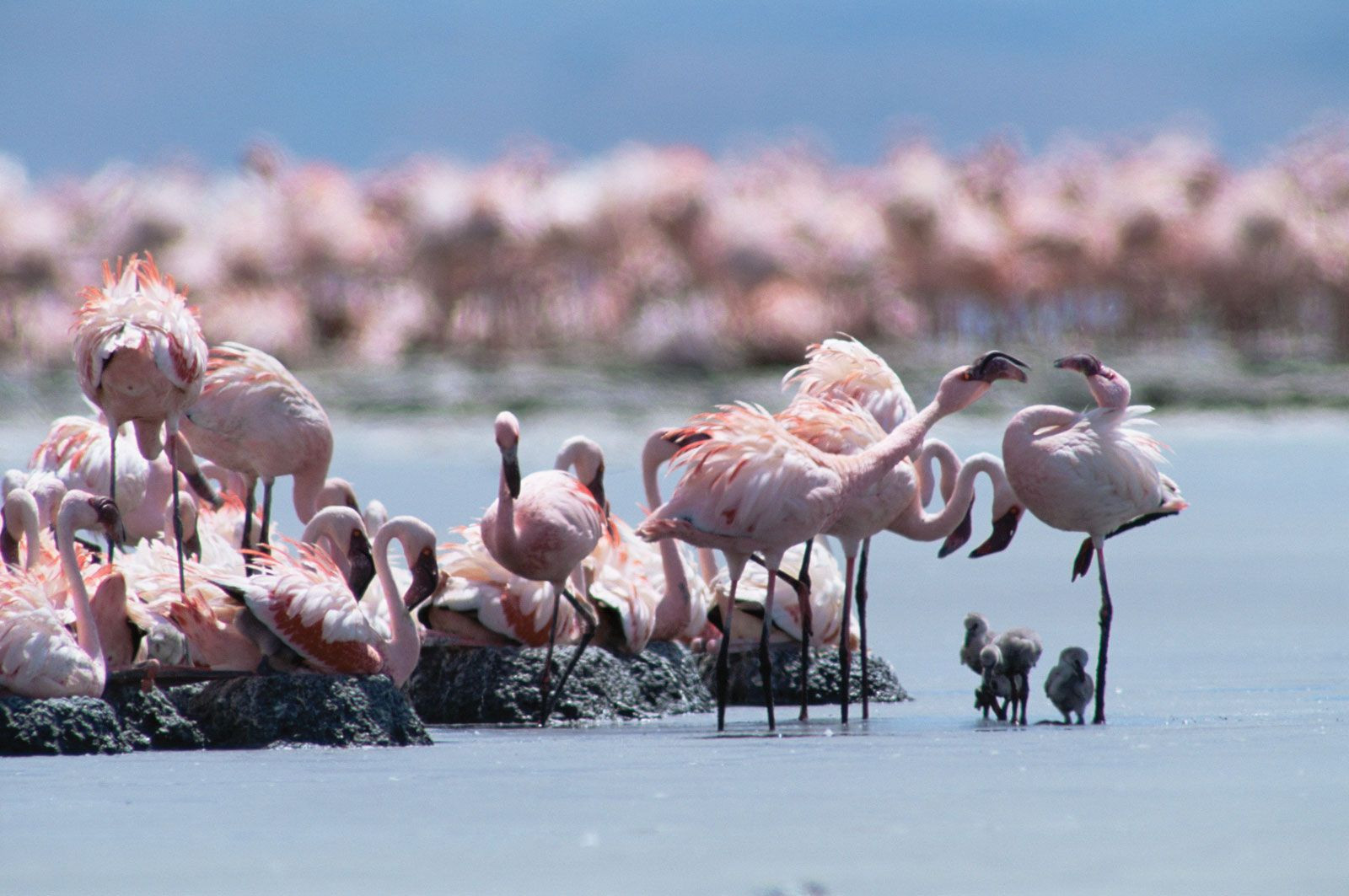
Lesser flamingos congregating at Lake Natron, highlighting the rich biodiversity supported by Tanzania’s water bodies.
Tanzania’s primary rivers, including the Ruvuma, Rufiji, Wami, and Pangani, all flow eastward into the Indian Ocean. The Rufiji, the largest among them, drains a vast area of southern mainland Tanzania. The Kagera River contributes to Lake Victoria, while smaller rivers feed into internal basins formed by the Great Rift Valley. This abundance of rivers positions mainland Tanzania as a region with substantial hydroelectric potential.
Soil Diversity Across Tanzania
The soils of mainland Tanzania are remarkably diverse, perhaps more so than any other African nation. The most fertile soils are the reddish-brown volcanic soils found in the highland regions. River basins also possess fertile soils, though they are prone to flooding and necessitate drainage management. Conversely, the red and yellow tropical loams of the interior plateaus exhibit moderate to poor fertility. In these plateau regions, high temperatures and limited rainfall accelerate oxidation, leading to low humus content and a clayey soil texture, unlike the desirable crumbly structure of temperate soils. Intense, albeit short-lived, tropical downpours further compact the soil, causing drainage issues and leaching away vital nutrients.
Climatic Zones of Tanzania
Mainland Tanzania can be broadly categorized into four principal climate and topographic zones:
- The hot and humid coastal lowlands: Bordering the Indian Ocean, this region experiences high humidity and temperatures.
- The hot and arid central plateau: A vast, dry expanse characterized by low rainfall and high temperatures.
- The high inland mountain and lake region: Situated along the northern border, home to Mount Kilimanjaro, this zone experiences cooler temperatures due to elevation.
- The highlands of the northeast and southwest: These areas exhibit climates ranging from tropical to temperate, influenced by altitude.
Tanzania’s equatorial climate is tempered by altitude variations. Consistent high solar radiation throughout the year results in minimal seasonal temperature fluctuations, typically less than 9 °F (5 °C). Ground frosts are rare below 8,200 feet (2,500 meters).
Rainfall patterns are highly seasonal, largely dictated by the intertropical convergence zone’s annual migration. Approximately half of mainland Tanzania receives less than 30 inches (750 mm) of annual rainfall, often considered the minimum for reliable crop cultivation in the tropics. The central plateau is the driest area, averaging less than 20 inches (510 mm) of rain annually, with a single rainy season from December to May. The coast experiences heavier rainfall with two peaks: October–November and April–May. Offshore islands and highland areas often receive high annual rainfall, exceeding 60 inches (1,520 mm).
Rich Plant and Animal Life in Tanzania
The historically low human population density has contributed to Tanzania’s exceptional wildlife richness. High-precipitation highland areas are covered in forests. The western and southern plateaus are dominated by miombo woodland, characterized by open tree cover including Brachystegia, Isoberlinia, Acacia, and Combretum trees. Drier regions are characterized by bushland and thicket. Poor drainage and agricultural burning have led to wooded grasslands in floodplains. Grasslands also emerge in areas with poor drainage, such as the Serengeti Plain, where a calcrete hardpan near the surface prevents tree growth. Swamps occur in perennially flooded areas. Desert and semidesert conditions range from alpine types at high altitudes to saline deserts in poorly drained areas, and arid deserts in extremely dry zones.
A giraffe feeding on acacia leaves in Tanzania, a common sight in the country’s diverse ecosystems.
Large herds of ungulates—wildebeests, zebras, giraffes, buffalo, gazelles, elands, dik-diks, and kudu—thrive in Tanzania’s numerous game parks. Predators include hyenas, wild dogs, and big cats like lions, leopards, and cheetahs. Crocodiles and hippos are abundant in rivers and lakes. The government prioritizes the protection of rhinoceroses and elephants from poaching. Chimpanzee communities inhabit Gombe National Park along Lake Tanganyika. Nearly 1,500 bird species have been recorded, alongside diverse snake and lizard species. Approximately one-fourth of Tanzania’s land is dedicated to reserves, conservation areas, and national parks. Several of these, including Serengeti National Park, Selous Game Reserve, Ngorongoro Conservation Area, and Kilimanjaro National Park, are UNESCO World Heritage sites, underscoring the global significance of Tanzania’s location and biodiversity.
A chimpanzee using a tool in Gombe National Park, Tanzania, illustrating the country’s rich primate life.
Conclusion: Tanzania’s Unique Geographical Identity
In conclusion, where is Tanzania? It is geographically positioned in East Africa, south of the equator, bordering the Indian Ocean and several other nations and lakes. Its diverse landscape, shaped by the Great Rift Valley and featuring Africa’s highest peak and the second deepest lake globally, contributes to its unique identity. From its varied climate zones and soil types to its extraordinary plant and animal life, Tanzania offers a compelling study in geographical diversity and ecological richness. This East African gem is not just a location on a map, but a vibrant and ecologically significant region within the African continent.


 Mount Kilimanjaro
 Flamingos