
Bhutan, often referred to as the “Land of the Thunder Dragon,” is a country that evokes images of serene monasteries perched on cliff sides, vibrant prayer flags fluttering in the wind, and breathtaking Himalayan landscapes. But Where Is Bhutan Located exactly? This question is fundamental to understanding this unique nation and its place in the world. Nestled in the heart of South Asia, Bhutan’s geographical position is key to its history, culture, and even its famed philosophy of Gross National Happiness.
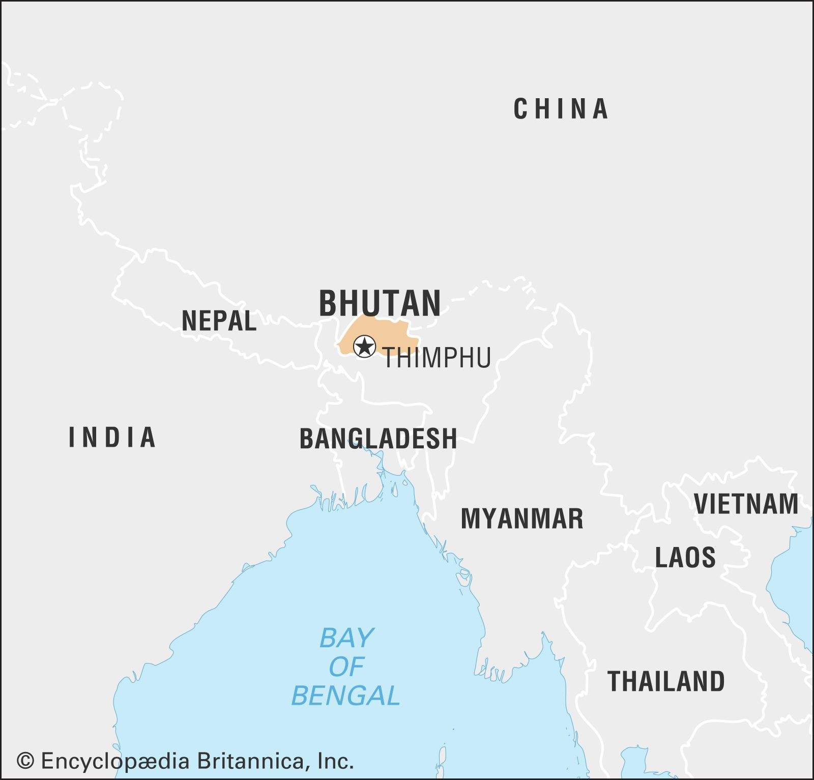
To pinpoint where Bhutan is located, imagine the vast Asian continent. Zoom in on the southern part, and you’ll find the majestic Himalayas, the world’s highest mountain range. Bhutan sits on the eastern ridges of these towering mountains, making it a landlocked country bordered by two giants: India to the south, west, and east, and China to the north. More specifically, Bhutan shares borders with the Indian states of Sikkim, West Bengal, Assam, and Arunachal Pradesh. To its north lies the Tibet Autonomous Region of China.
 Bhutan world data locator map
Bhutan’s location in South Asia, highlighted on a world map, emphasizing its position within the Himalayan region and proximity to India and China.
Delving Deeper into Bhutan’s Geographical Coordinates
Understanding Bhutan’s location goes beyond just naming neighboring countries. Geographically, Bhutan is situated between 26°45′ and 28°10′ North latitude, and 88°45′ and 92°10′ East longitude. This places it in a region characterized by dramatic elevation changes, from the subtropical plains in the south to the towering, snow-capped Himalayan peaks in the north. This varied topography significantly influences Bhutan’s climate, biodiversity, and population distribution.
Bhutan’s capital city, Thimphu, is located in the western central part of the country, nestled within one of the fertile valleys of the Lesser Himalayas. This valley, along with the Paro Valley, has historically been the political and economic heartland of Bhutan.
The Strategic Significance of Bhutan’s Location
The location of Bhutan is not merely a matter of geographical coordinates; it carries significant geopolitical weight. Positioned between India and China, two of the world’s most populous and influential nations, Bhutan’s location has shaped its foreign policy and its delicate balancing act in international relations.
Historically, Bhutan’s isolation was partly a consequence of its rugged terrain and remote location. However, this isolation also served as a buffer, protecting its unique cultural identity and way of life. In the 20th century, with improved transportation and changing geopolitical dynamics, Bhutan gradually opened up to the world, while carefully navigating its relationships with its powerful neighbors.
Bhutan’s Location and its Diverse Landscapes
The unique location of Bhutan in the Eastern Himalayas is the primary factor behind its incredibly diverse landscapes. The country can be broadly divided into three geographical zones from north to south:
The Great Himalayas
In the northern reaches of Bhutan lie the Great Himalayas, a region of towering, snow-covered peaks exceeding 24,000 feet (7,300 meters). Glaciers carve through these mountains, feeding the rivers that flow southward. This area is characterized by a harsh, dry climate and is sparsely populated, mainly used for summer yak grazing in high alpine pastures. Until the mid-20th century, trade routes through these high passes connected Bhutan with Tibet, highlighting the historical importance of Bhutan’s location as a crossroads.
A physical map of Bhutan, illustrating the three main geographical regions: the Great Himalayas, Lesser Himalayas, and Duars Plain, showcasing the varied topography resulting from its location in the Himalayas.
The Lesser Himalayas
Moving southward, we encounter the Lesser Himalayas, also known as the Inner Himalayas. This region is characterized by a network of ranges radiating southward from the Great Himalayas, forming watersheds for Bhutan’s major rivers. Fertile valleys, such as Paro, Punakha, Thimphu, and Ha, are nestled within these ranges at elevations between 5,000 to 9,000 feet (1,500 to 2,700 meters). These valleys, thanks to their moderate rainfall and relatively flat terrain, are the most populated and cultivated areas of Bhutan, demonstrating how Bhutan’s location within the Himalayas creates pockets of habitable land.
The Duars Plain
Finally, in the southernmost part of Bhutan lies the Duars Plain, a narrow strip bordering India. This plain is a stark contrast to the mountainous regions to the north. Hot, humid, and receiving torrential rainfall, the Duars Plain is covered in dense semi-tropical forests. Historically, this plain served as a gateway (dwars or dooars meaning “doors”) to the strategic mountain passes leading into the inner valleys, further emphasizing the significance of Bhutan’s location for access and defense.
Conclusion: Bhutan’s Location as a Defining Feature
In conclusion, where Bhutan is located is far more than a simple geographical fact. Its position in the Eastern Himalayas, nestled between India and China, has profoundly shaped its history, culture, landscape, and geopolitical significance. From the towering peaks of the Great Himalayas to the lush plains of the Duars, Bhutan’s diverse geography, dictated by its location, is a key element in understanding and appreciating this remarkable country. Exploring Bhutan’s location is the first step in unraveling the mysteries and wonders of the Dragon Kingdom.