Turkey, officially known as the Republic of Türkiye, holds a fascinating geographical position that has shaped its history and culture. Situated uniquely at the meeting point of two continents, it acts as both a bridge and a divider between Asia and Europe. Understanding Where Is Turkey Located is key to grasping its geopolitical significance and diverse cultural landscape.
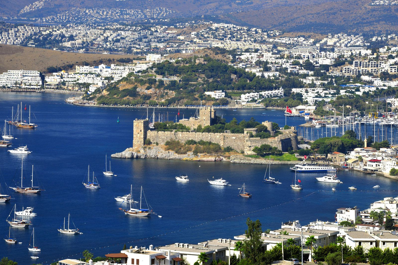 Castle of St. Peter in Bodrum, Turkey, showcasing coastal architecture
Geographically, Turkey straddles Southeastern Europe and Western Asia. A significant portion of the country, approximately 97%, lies in Asia, specifically on the peninsula of Asia Minor, also known as Anatolia (or Anadolu). This vast Asian part is where the heartland of Turkey resides, encompassing diverse landscapes from coastal plains to high plateaus and mountains, including part of the Armenian Highland in the east. The remaining, smaller part of Turkey, known as Turkish Thrace (or Trakya), is situated in Southeastern Europe. This European section, though small, is historically significant as the remnant of the Ottoman Empire’s once extensive European territories.
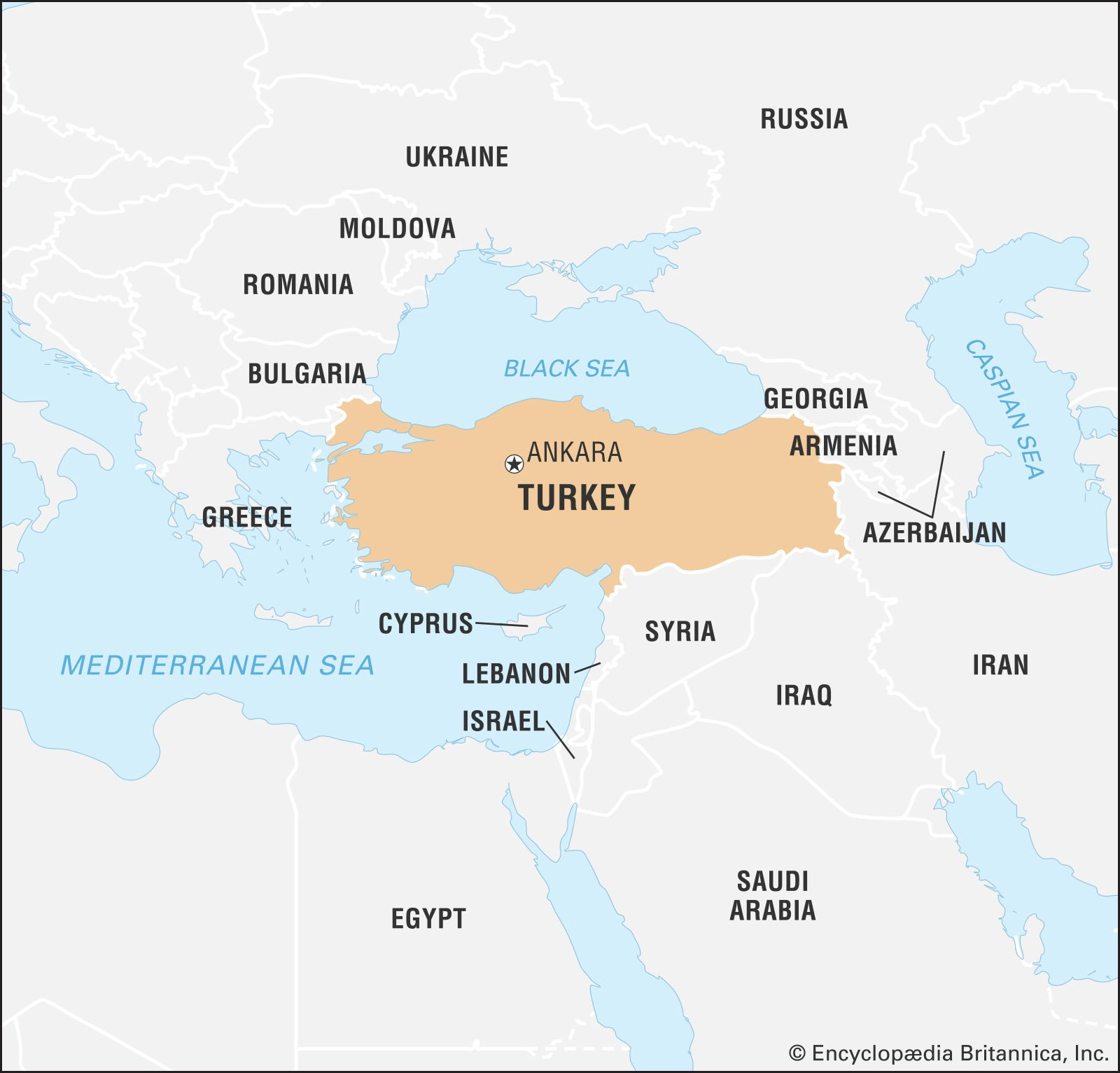 Locator map of Turkey in the world, highlighting its transcontinental position
Turkey’s location places it at the crossroads of several important regions. It bridges the Balkans to its northwest, the Caucasus to its northeast, the Middle East to its southeast, and the eastern Mediterranean to its south. This strategic positioning makes Turkey a pivotal country in regional and global dynamics. In terms of size, Turkey is one of the larger nations in its region, with a land area exceeding that of any single European country.
Turkey boasts extensive borders, both land and sea. To its north, Turkey is bordered by the Black Sea, offering crucial maritime access. Moving northeast, its neighbors are Georgia and Armenia. Eastward, Turkey shares borders with Azerbaijan and Iran. To the southeast, Iraq and Syria form its boundaries. The southwestern and western edges of Turkey are defined by the Mediterranean Sea and the Aegean Sea, respectively, providing long coastlines and strategic sea routes. Finally, to the northwest, Turkey is bordered by Greece and Bulgaria in Europe. The capital city of Turkey is Ankara, centrally located in Anatolia, while Istanbul, the largest city and a major seaport, uniquely spans both Europe and Asia.
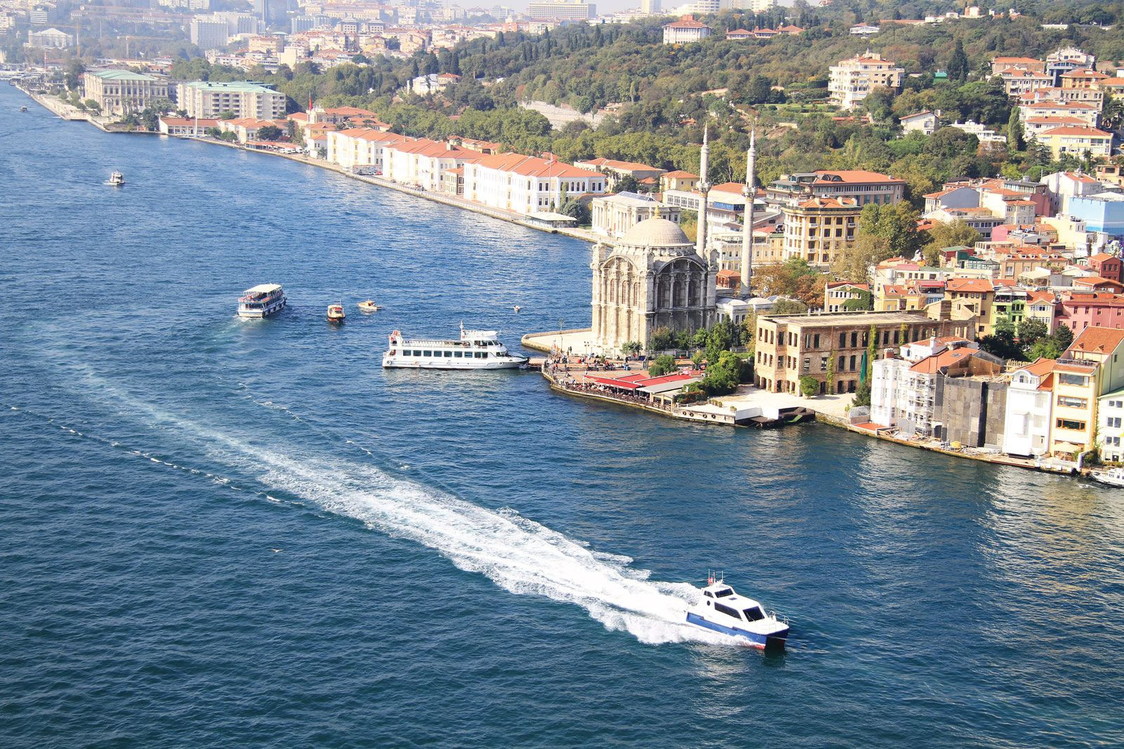 Boats navigating the Bosporus River in Istanbul, Turkey, a key waterway
A significant feature of Turkey’s geography is its control over the Turkish Straits. These straits, comprising the Bosporus, the Sea of Marmara, and the Dardanelles, connect the Black Sea to the Aegean Sea and the Mediterranean. As the sole outlet from the Black Sea, these straits are of immense strategic importance, influencing Turkey’s relationships with other nations, particularly those bordering the Black Sea. While most islands along the Aegean coast belong to Greece, Turkey retains control over the islands of Gökçeada and Bozcaada.
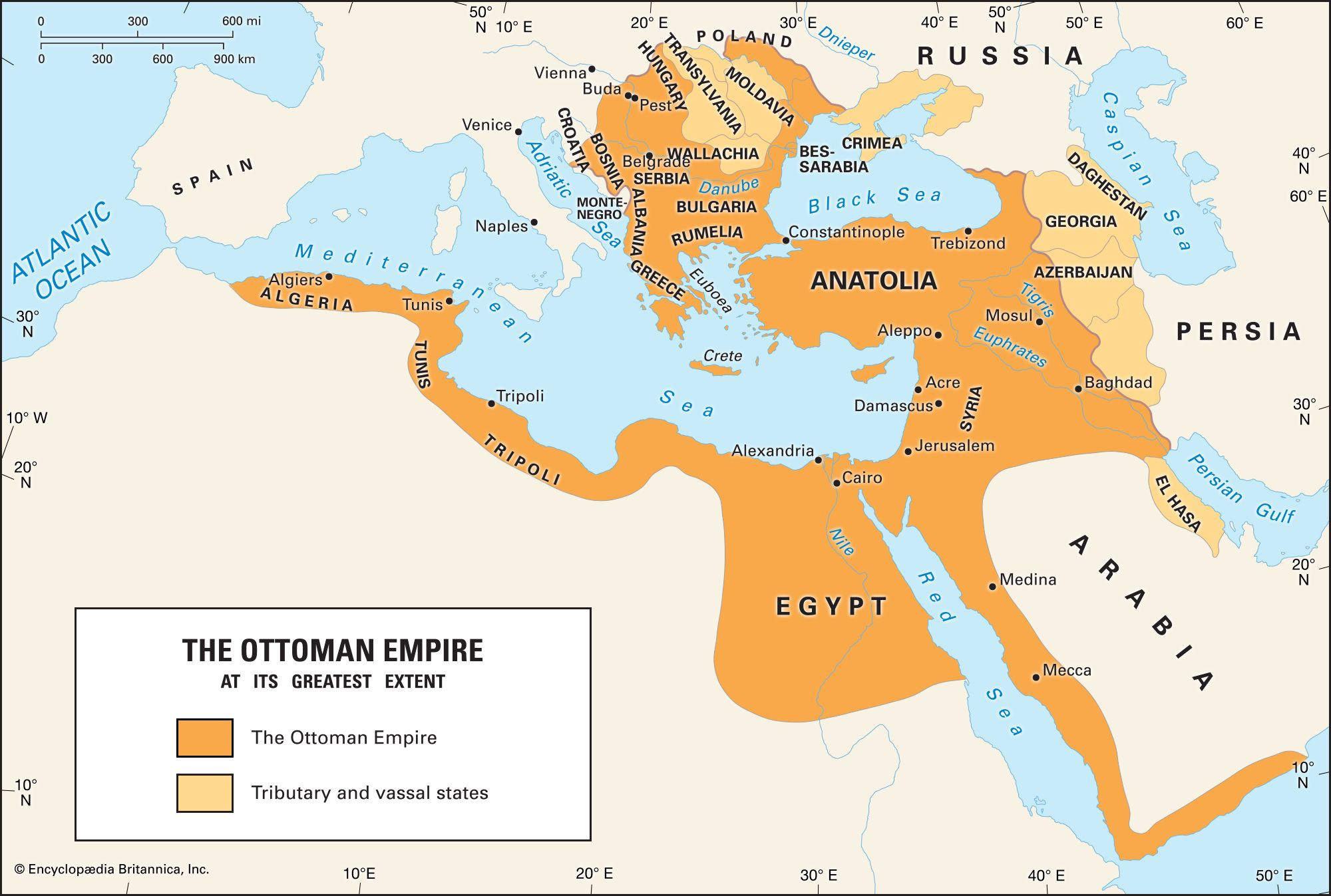 Map depicting the Ottoman Empire at its peak extent, illustrating historical influence
Throughout history, the lands of present-day Turkey have been home to numerous civilizations and empires. From ancient Anatolian civilizations to the powerful Ottoman Empire, which rose to prominence in the 14th century and reached its zenith in the 17th, the region has been a center of cultural and political power. The modern Republic of Turkey emerged in 1923 from the ashes of the Ottoman Empire, establishing itself as a secular democracy.
In conclusion, Turkey’s location is not just a matter of lines on a map; it is a defining characteristic of the nation. Its transcontinental position, bordering diverse regions and controlling vital straits, has made Turkey a significant player in global history and contemporary geopolitics. Understanding where Turkey is located provides essential context for appreciating its culture, history, and ongoing international role.