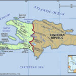
Nestled in the heart of the Caribbean, the Dominican Republic shares the island of Hispaniola with Haiti, occupying the eastern two-thirds. This prime location places it strategically between North and South America, making it a vibrant part of the West Indies archipelago. Understanding the Dominican Republic’s location is key to appreciating its diverse landscapes, climates, and rich biodiversity.
The Dominican Republic boasts a varied topography, featuring both the highest and lowest points in the West Indies. Its geographical narrative is sculpted by a series of mountain ranges and fertile valleys that predominantly run from northwest to southeast, influencing everything from its river systems to its agricultural heartlands.
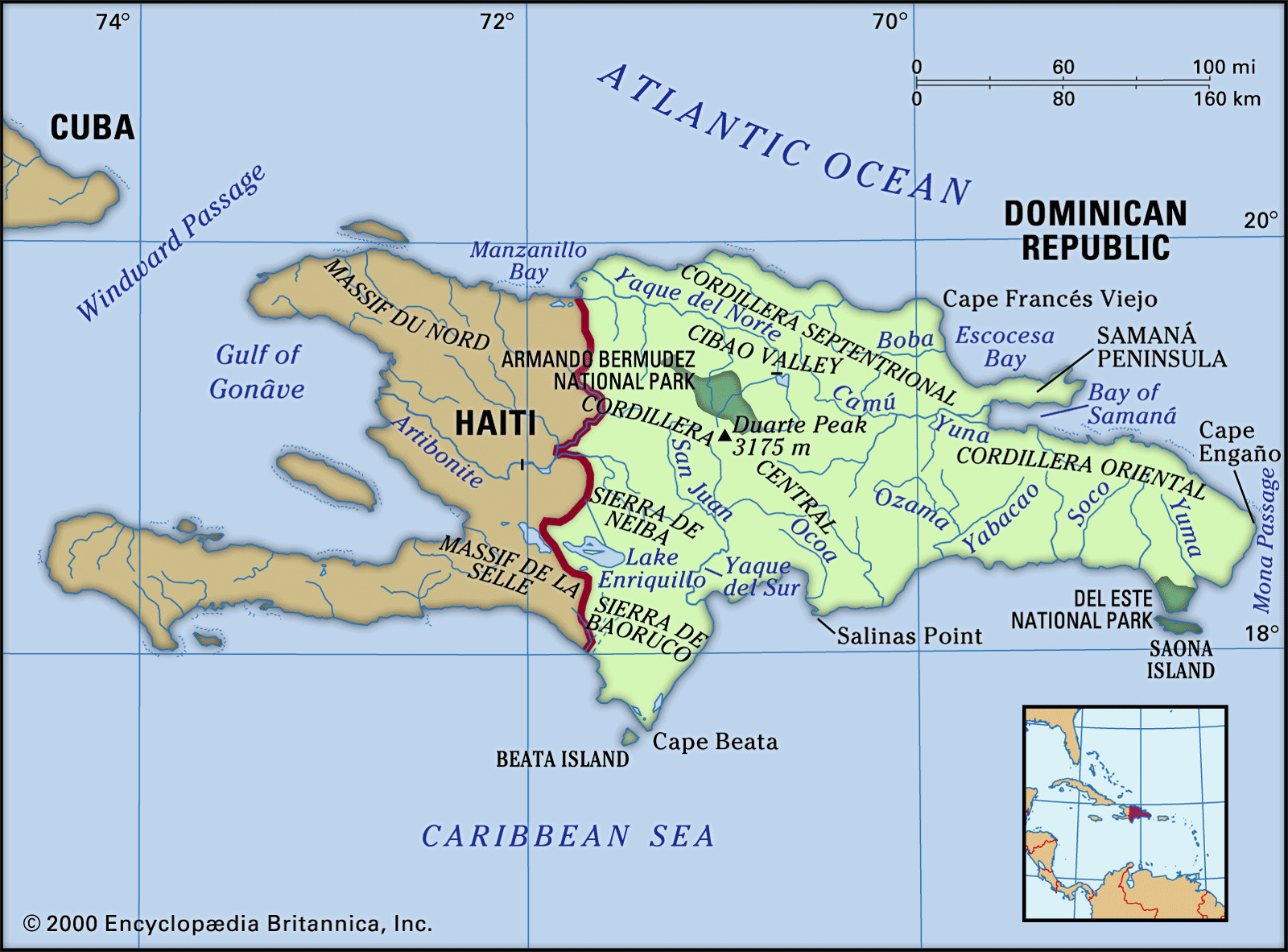 Map depicting the physical features of the Dominican Republic, including mountain ranges, valleys, and rivers.
The northern region is marked by the Cordillera Septentrional mountains, rising above a slender coastal plain. This area is crisscrossed by short rivers like the Balabonico and Yasica. Moving south from these mountains, the landscape opens into the expansive Cibao Valley. This fertile stretch extends from Manzanillo Bay in the northwest to the Samaná Peninsula and the Bay of Samaná in the east. The Cibao Valley is the agricultural heartland, nourished by the Yaque del Norte river system, flowing northwest, and the Camu-Yuna system, heading east.
Dominating the island’s geography is the Cordillera Central, known as Massif du Nord in Haiti. This imposing mountain range, the Caribbean’s most rugged, features peaks averaging around 6,000 feet (1,800 metres). Here, you’ll find Duarte Peak, reaching 10,417 feet (3,175 metres), the highest point in the Caribbean. The Cordillera Central’s northern slopes feed tributaries of the Yaque del Norte, while the southern flanks are drained by the Yaque del Sur system, along with rivers like the Ocoa and Nizao. The San Juan River anchors the fertile San Juan Valley, connecting to Haiti’s Central Plateau via the Artibonite River valley.
South of the San Juan Valley lies the Sierra de Neiba range, mirroring Haiti’s Matheux and Trou d’Eau mountains, with peaks reaching approximately 7,200 feet (2,200 metres). Water from this range flows both to the Caribbean Sea, via the Yaque del Sur, and inland to Lake Enriquillo. Lake Enriquillo, the Dominican Republic’s largest natural lake, is also the lowest point in the West Indies, sitting 144 feet (44 metres) below sea level. Further south, the Sierra de Baoruco (Bahoruco), known as Massif de la Selle in Haiti, overlooks Cape Beata and the arid southwestern plain, including the Pedernales region.
In the east, the Cordillera Oriental forms a less rugged spine. It separates a narrow northern coastal plain from wider lowlands to the south, the prime sugarcane growing area. Rivers in this region, such as the Ozama (flowing through Santo Domingo), Macorís, Soco, Chavón, and Yuma, all drain into the Caribbean Sea.
The Dominican Republic’s location within the tropics blesses it with a moderate tropical climate, tempered by elevation and the constant northeast trade winds from the Atlantic. The average annual temperature is a pleasant 77 °F (25 °C), varying from 69 °F (21 °C) in the Cordillera Central to 82 °F (28 °C) on the coasts. Temperatures rarely exceed 90 °F (32 °C), and freezing temperatures are unheard of.
Rainfall distribution is heavily influenced by the trade winds and mountain ranges. The northeastern mountains receive the most rain, exceeding 100 inches (2,540 mm) annually. As the winds move across the country, they lose moisture, resulting in drier conditions in the western and southwestern valleys near Haiti, with less than 30 inches (760 mm) of annual precipitation. The northwest and southeast regions also experience aridity. Being in the Caribbean, the Dominican Republic is within the hurricane belt and occasionally experiences tropical storms, particularly between August and October.
The Dominican Republic’s geographical location and varied topography contribute to diverse vegetation zones. Mountainous areas are still largely forested with pines and hardwoods, though lower slopes have suffered from deforestation. Drier regions feature shrubs and scrub, while rainforests and grasslands thrive in wetter areas. Royal palms are ubiquitous. Fertile valleys and lower slopes are now largely cultivated. Mangrove swamps fringe parts of the coast, contrasting with extensive sandy beaches, particularly along the north shore.
While not teeming with large wildlife, the Dominican Republic’s location has shaped its fauna. Introduced cattle and goats roam grasslands and deserts. Alligators inhabit areas near the Yaque river mouths and Lake Enriquillo. A rich variety of birdlife, including ducks, are present. The surrounding Caribbean waters, especially coral reefs, are home to diverse fish and shellfish.
In conclusion, the Dominican Republic’s location in the Caribbean, its diverse geography, and tropical climate create a unique and vibrant island nation. From towering mountains to fertile valleys and beautiful coastlines, its geographical attributes are fundamental to understanding its ecology, agriculture, and overall appeal as a Caribbean destination.