Nestled in the vast expanse of the central Pacific Ocean, the Marshall Islands is a nation that epitomizes the idyllic island paradise. Comprising a captivating archipelago, this country is a key part of Micronesia, holding a unique geographical and cultural significance in this region of the world. To truly understand the allure of this island nation, it’s essential to pinpoint exactly Where Are The Marshall Islands Located and explore the geographical context that shapes its identity.
Geographic Location and Context within Micronesia
The Marshall Islands are strategically positioned within Micronesia, a subregion of Oceania. To be precise, they occupy the easternmost reaches of Micronesia. Imagine a map of the Pacific Ocean; the Marshall Islands reside just north of the equator and west of the International Date Line. This location places them in the heart of the Pacific, surrounded by immense stretches of open sea, contributing to their remote and pristine nature.
Geographically, the nation is composed of two parallel island chains: the Ratak (Sunrise) Chain to the east and the Ralik (Sunset) Chain to the west. These chains, stretching approximately 800 miles in a northwest-to-southeast direction, are separated by about 125 miles of ocean. This dual-chain structure is a defining characteristic of the Marshall Islands’ geography, contributing to its scattered presence across a large oceanic area. Neighboring countries further contextualize the Marshall Islands’ location. Wake Island lies to the north, while Kiribati and Nauru are situated to the south. To the west, you’ll find the Federated States of Micronesia, further emphasizing the Marshall Islands’ integral position within this island grouping.
Understanding the Atoll Structure of the Marshall Islands
The landscape of the Marshall Islands is uniquely defined by its coral atoll formations. Comprising 29 low-lying coral atolls and five coral islands, none of these landmasses rise more than 20 feet above high tide. These islands are essentially coral caps, formed on the rims of submerged volcanoes that ascend from the ocean floor. This atoll structure is crucial to understanding the geography and environment of the Marshall Islands.
Notably, the Marshall Islands are home to Kwajalein Atoll, the largest atoll in the world by lagoon area. While its land area is a mere six square miles, it encloses a vast lagoon spanning 655 square miles. Most of the islands are true atolls, characterized by an irregular, oval-shaped coral reef that encircles a lagoon, with islets scattered along the reef. The Ratak chain islands are generally more densely wooded compared to those in the Ralik chain. Coconut and pandanus palms, along with breadfruit trees, constitute the primary vegetation, thriving in the sandy, albeit less fertile, soils.
Key Islands and Urban Centers within the Archipelago
While spread across numerous islands and atolls, the population of the Marshall Islands is concentrated in specific areas. Majuro Atoll serves as the nominal capital, with government operations based in Delap-Uliga-Djarrit, a town formed by landfill connecting three once-separate islands. Another significant atoll is Kwajalein, which hosts a U.S. missile testing range, providing substantial employment opportunities and contributing to its population density.
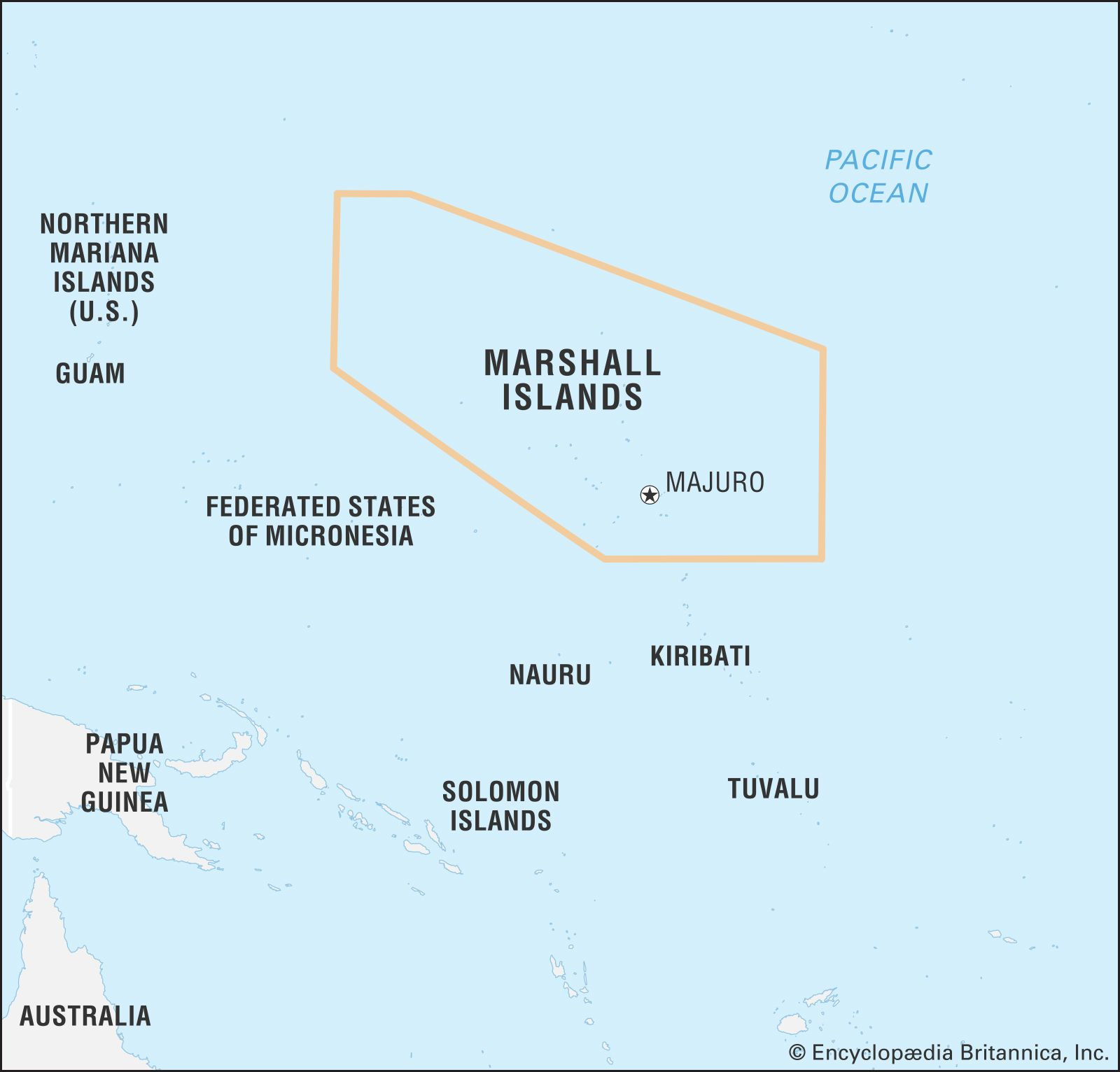 Map showing the location of the Marshall Islands in the vast expanse of the Pacific Ocean, highlighting its position in Micronesia.
These two atolls, Majuro and Kwajalein, are the primary urban centers and are home to almost three-quarters of the nation’s total population. The remaining population resides in traditional villages on the outer islands, maintaining a more traditional lifestyle away from the bustling centers.
Climate and Environment of the Marshall Islands
The Marshall Islands enjoy a tropical climate, characterized by consistently warm temperatures. The mean annual temperature across the islands is around 82°F (28°C). Rainfall varies significantly across the archipelago, ranging from 20 to 30 inches annually in the drier northern atolls to as much as 160 inches in the southern atolls. October and November are typically the wettest months. The northern atolls, facing water scarcity due to lower rainfall, are often uninhabited.
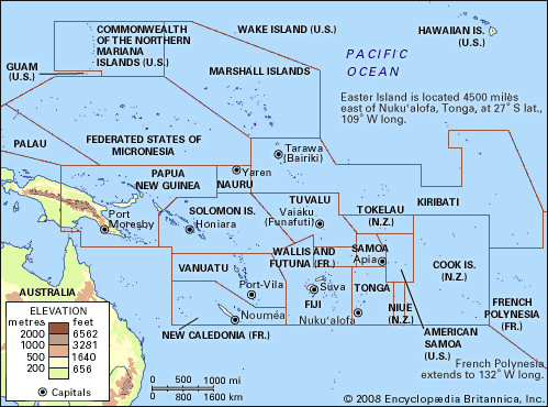 Detailed map of the Pacific Islands region, illustrating the Marshall Islands' geographical context among neighboring island nations in Micronesia.
This tropical island nation, while geographically blessed with stunning natural beauty, is also vulnerable to the impacts of climate change, particularly rising sea levels, due to its low-lying atoll structure. Understanding the location of the Marshall Islands is not just about pinpointing it on a map, but also appreciating its unique environmental context and the challenges it faces.
In conclusion, the Marshall Islands are located in the central Pacific Ocean, within the Micronesia subregion of Oceania. Their unique position, defined by two parallel chains of coral atolls, their tropical climate, and their cultural significance within the Pacific, makes them a fascinating and important island nation in this vast oceanic realm. Understanding where are the Marshall Islands located provides a crucial foundation for appreciating their geography, culture, and place in the world.