Patagonia, a name that conjures images of dramatic landscapes, glaciers, and towering mountains, is a region of unparalleled beauty. But Where Is Patagonia Located exactly? This vast and sparsely populated area sits at the southern end of South America, shared by both Argentina and Chile. Understanding its precise location is key to appreciating its unique geography and climate.
Patagonia is primarily situated within Argentina and Chile. On the South American continent, it stretches across the Andes Mountains in the west to the Atlantic Ocean in the east. Geographically, Patagonia begins roughly at the Colorado River in Argentina and extends southward to Tierra del Fuego, encompassing a diverse range of terrains.
Geographical Location of Patagonia: Delving Deeper
Patagonia isn’t confined to a single country; it’s a transcontinental region. The Andes Mountains serve as a natural boundary, dividing Patagonia between Argentina to the east and Chile to the west. Let’s break down its location further:
-
Argentina Patagonia: Argentine Patagonia is the larger portion, encompassing the provinces of Río Negro, Neuquén, Chubut, Santa Cruz, and Tierra del Fuego. It’s characterized by vast plateaus, steppes, and a long Atlantic coastline.
-
Chilean Patagonia: Chilean Patagonia includes the southern portion of Chile, encompassing regions like Los Lagos, Aysén, and Magallanes. This part of Patagonia is defined by the dramatic Andes Mountains, fjords, rainforests, and numerous islands along the Pacific coast.
The longitudinal extent of Patagonia is significant, stretching from approximately 39° South latitude to almost 56° South latitude. This southward reach contributes to its varying climates and ecosystems. To visualize it, Patagonia occupies the bottom portion of South America, tapering towards the southern tip of the continent.
Physical Features of Patagonia: A Land of Contrasts
Patagonia’s location dictates its remarkable physical features. From arid deserts to glacial fields, the region presents a stunning variety of landscapes.
Physiography: Steppes, Deserts, and Tablelands
The expansive Patagonian Desert, a blend of desert and semidesert terrain, dominates the Patagonian tableland, stretching from the Andes to the Atlantic coast.
Much of eastern Patagonia is characterized by the Patagonian tableland, a vast expanse of steppelike plains largely devoid of trees. This tableland rises in terraces from the Atlantic coast towards the Andes. Near the Negro River, the land ascends from roughly 300 feet at the coast to about 1,300 feet inland, reaching 3,000 feet at the Andean foothills. The tableland further west can reach altitudes of 5,000 feet.
South of the Negro River, the landscape becomes more irregular, shaped by past volcanic activity. Basalt sheets cover areas east of Lakes Buenos Aires and Pueyrredón. Massive basalt formations punctuate the landscape, especially near the Chico and Santa Cruz rivers. The coastline is largely composed of high cliffs bordering a narrow coastal plain. The plateaus are formed from horizontal layers of sedimentary rocks and lava flows, with hilly areas of crystalline rocks rising above them.
Drainage and Soils: Rivers Carving the Land
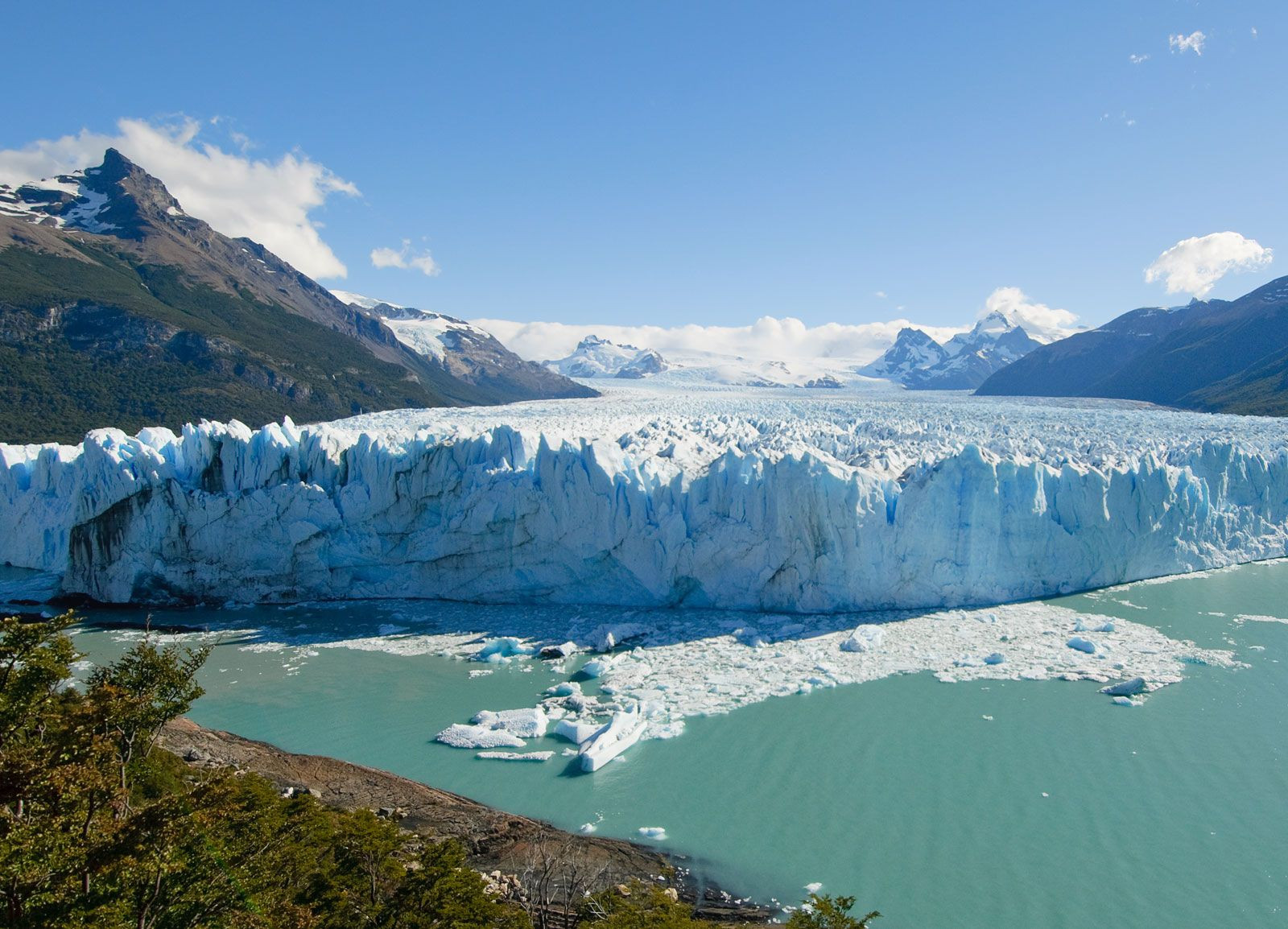
 Perito Moreno glacier
Argentina’s Perito Moreno Glacier, a testament to Patagonia’s icy landscapes, illustrates the region’s cold climate conducive to glacial formations.
Deep, wide valleys, carved by ancient rivers flowing from the Andes to the Atlantic, dissect the Patagonian tablelands. While many of these valleys are now dry or contain intermittent streams, a few rivers of Andean origin, such as the Colorado, Negro, Chubut, and Santa Cruz, still flow permanently. Other rivers are seasonal or disappear entirely due to wind and sand erosion. Some streams even terminate in salt flats or ponds. The valley floors are rich in alluvial sands and gravels, acting as groundwater reservoirs.
Along the Andean border of Patagonia, a chain of lakes occupies glacial troughs and cirques, dammed by moraines. North of Lake Nahuel Huapí, most lakes drain eastward to the Atlantic. However, south of this lake, the majority drain westward to the Pacific through deep canyons cut across the cordillera.
The most fertile soils in Patagonia are located north of the Negro River, particularly those derived from volcanic rock. Moving southward, soils become drier and stonier, with extensive areas covered in grava patagónica, stream-rounded pebbles found on level ground.
Climate: Two Distinct Zones
Patagonia’s climate is heavily influenced by its southern location and the South Pacific westerly air current. Winds from the Pacific Ocean lose moisture as they cross the Andes, resulting in dry conditions in Patagonia. The region is generally divided into two climate zones:
-
Northern Patagonia: This zone is semiarid with average annual temperatures between 54 and 68 °F (12 and 20 °C). While sunshine is limited along the coast, it’s more abundant inland. Annual rainfall ranges from about 3.5 to 17 inches. Strong, dry, and cold winds typically blow from the southwest.
-
Southern Patagonia: Southern Patagonia has a cold, dry climate, with coastal areas being milder than inland locations. Strong westerly winds are prevalent. Mean annual temperatures range from 40 to 55 °F (4 to 13 °C). Winters bring heavy snowfall, and frosts can occur year-round. Spring and autumn are short transitional seasons. Average annual precipitation varies between 5 and 8 inches, although some areas can receive up to 19 inches. The central arid regions receive less precipitation and more sunshine.
Conclusion: Patagonia’s Location Defines Its Identity
In conclusion, Patagonia is located at the southern tip of South America, primarily within Argentina and Chile, stretching from the Andes to the Atlantic and Pacific Oceans. Its geographical position dictates its diverse physical features, ranging from deserts and steppes to glacial mountains and fjords, and its distinctive climate zones. Understanding where Patagonia is located is the first step to appreciating the unique character and breathtaking beauty of this remarkable region.