Hurricane Milton, a name that might be fading from recent memory for some, struck Florida just a couple of weeks ago, leaving a trail of impacts in its wake. For those still recovering from Hurricane Helene or simply trying to keep up with the rapid pace of storm events, questions linger, especially concerning the specifics of Milton’s arrival. One of the most common queries on search engines revolves around pinpointing Where Did Milton Make Landfall in Florida. As we monitor the tropics for potential new storms during this active hurricane season, it’s crucial to revisit and clarify the details of Hurricane Milton. This article addresses the key questions surrounding this recent storm, providing a clear understanding of its landfall and subsequent impacts on the Sunshine State.
Hurricane Milton’s Landfall Location and Time
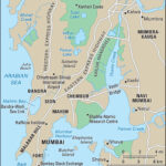
Hurricane Milton officially made landfall on Florida’s Gulf Coast at 8:30 p.m. EDT on Wednesday, October 9, 2024. This precise timing is crucial for understanding the storm’s progression and the sequence of events that followed. The location of landfall was specifically near Siesta Key, a barrier island renowned for its beautiful beaches, situated approximately 5 miles west of Sarasota. This area bore the initial brunt of the storm’s force as it moved inland.
Hurricane Milton’s Path Across Florida
Following its landfall near Siesta Key, Hurricane Milton embarked on a path across the Florida peninsula. Moving eastward, the storm traversed Central Florida and emerged into the Atlantic Ocean northeast of Cape Canaveral around 5:00 a.m. EDT on October 10th. Remarkably, even after crossing the entire state, Milton maintained its hurricane status. It still packed sustained winds of 85 mph as it moved back over water, demonstrating the storm’s intensity and resilience. This trans-Florida path meant that a wide swathe of the state experienced Milton’s impact, from the Gulf Coast to the Atlantic side.
The Unprecedented Tornado Outbreak from Hurricane Milton
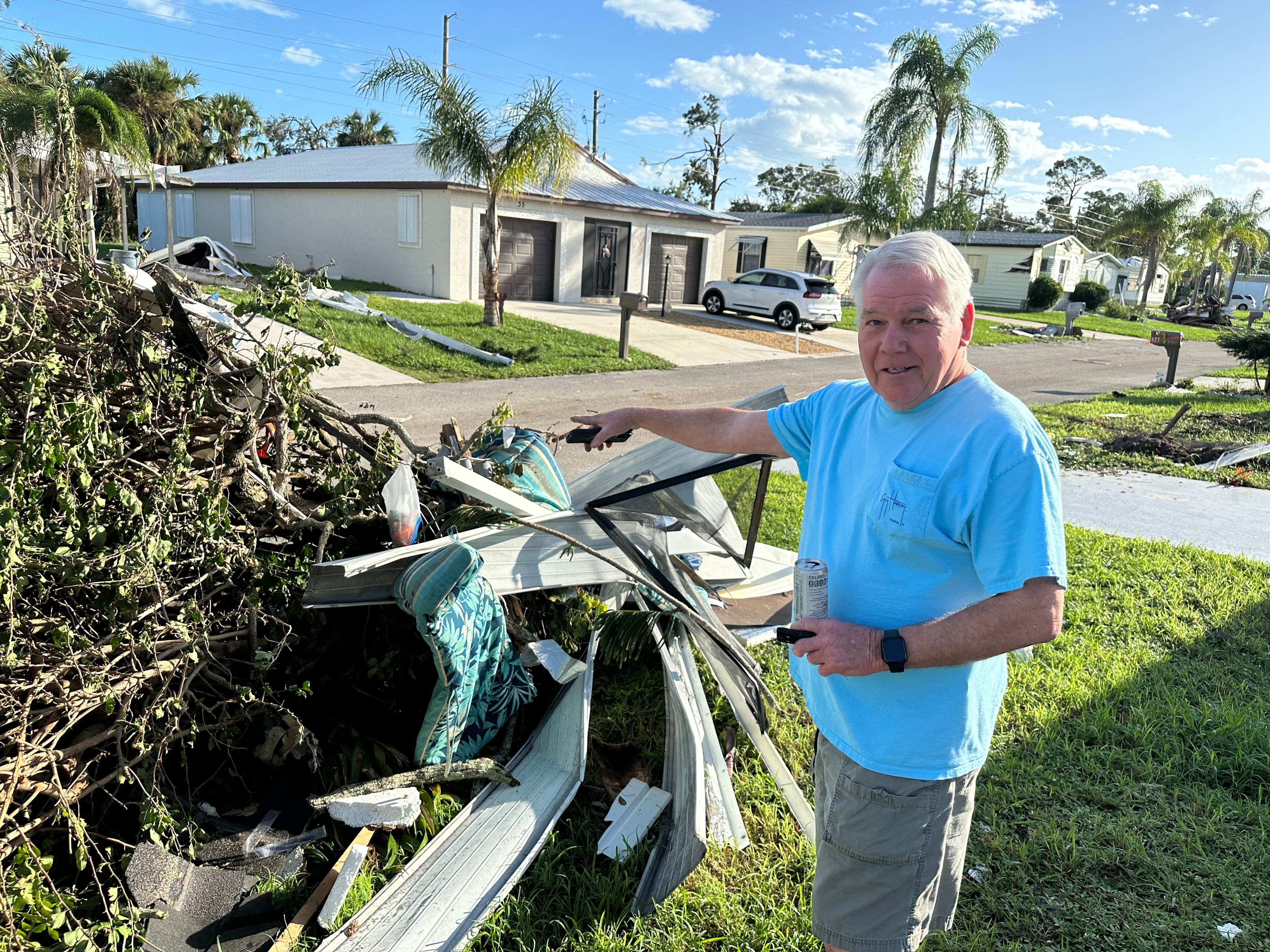 Debris and damage in a residential area after a tornado in Spanish Lakes Country Club Village
One of the most striking and devastating aspects of Hurricane Milton was the sheer number of tornadoes it spawned across Florida. Meteorologists from the National Weather Service have confirmed that Hurricane Milton generated at least 41 tornadoes. This is a record-breaking number for a hurricane in Florida and highlights the dangerous secondary effects of these powerful storms. Among these tornadoes were three rare and intense EF3 tornadoes, packing peak winds between 140 and 155 mph. The final count of tornadoes could potentially rise as damage surveys are completed, underscoring the widespread and intense nature of this tornado outbreak. Tragically, one tornado in St. Lucie County resulted in six fatalities, adding to the storm’s devastating human cost. The EF3 tornadoes impacted Palm Beach, Glades, St. Lucie, and Indian River counties, leaving significant damage in their wake.
Hurricane Milton’s Category 5 Strength Before Landfall
It’s important to note that while Hurricane Milton made landfall as a Category 3 storm, it had previously reached monstrous Category 5 status. Just two days before landfall, on Monday, October 7th, Hurricane Milton was an extremely dangerous Category 5 hurricane with winds reaching 180 mph. Fortunately, prior to reaching the Florida coast, Milton encountered increasing wind shear, which caused it to weaken somewhat before landfall. Despite this weakening, it still made landfall as a significant Category 3 hurricane, causing widespread impacts.
The impacts across east Central Florida were substantial. Beyond the tornado outbreak, the region experienced hurricane-force wind gusts that downed trees and power lines, causing damage to numerous homes and businesses. Furthermore, the northern side of Hurricane Milton brought torrential rainfall, with total amounts ranging from 10 to 15 inches and even higher in some areas. This extreme rainfall led to localized flooding and caused rises in area rivers and creeks. Notably, St. Petersburg recorded an astonishing 20.40 inches of rain, illustrating the deluge associated with Milton. Storm surge flooding also devastated areas south of the storm’s eye landfall point, compounding the overall damage.
Hurricane Milton in the Context of Florida’s 2024 Hurricane Season
Hurricane Milton is significant not only for its individual impacts but also for its place within the broader context of Florida’s 2024 hurricane season. This year, Florida has witnessed an unusual number of landfalling hurricanes. With Milton, Florida has now had three hurricanes make landfall in 2024, tying a record that has only been set in five other years in recorded history. This underscores the particularly active and impactful nature of this hurricane season for Florida.
To provide further context, let’s look at the details of the other two hurricanes that made landfall in Florida in 2024:
Hurricane Debby
- Landfall: Near Steinhatchee at 7:00 a.m. EDT on August 5th.
- Strength at Landfall: Category 1, with sustained winds of 80 mph.
Hurricane Helene
- Landfall: Near Perry at 11:25 p.m. EDT on September 26th.
- Strength at Landfall: Category 4, with sustained winds of 140 mph.
Hurricane Milton (Reiterated)
- Landfall: Near Siesta Key at 8:30 p.m. EDT on October 9th.
- Strength at Landfall: Category 3, with sustained winds of 120 mph.
In conclusion, Hurricane Milton made landfall near Siesta Key, Florida, on October 9th, 2024, bringing significant hurricane-force winds, a record-breaking tornado outbreak, and torrential rainfall. Its impact, combined with Hurricanes Debby and Helene, marks 2024 as an exceptionally active hurricane season for Florida, highlighting the ongoing vulnerability of the state to these powerful weather events.