
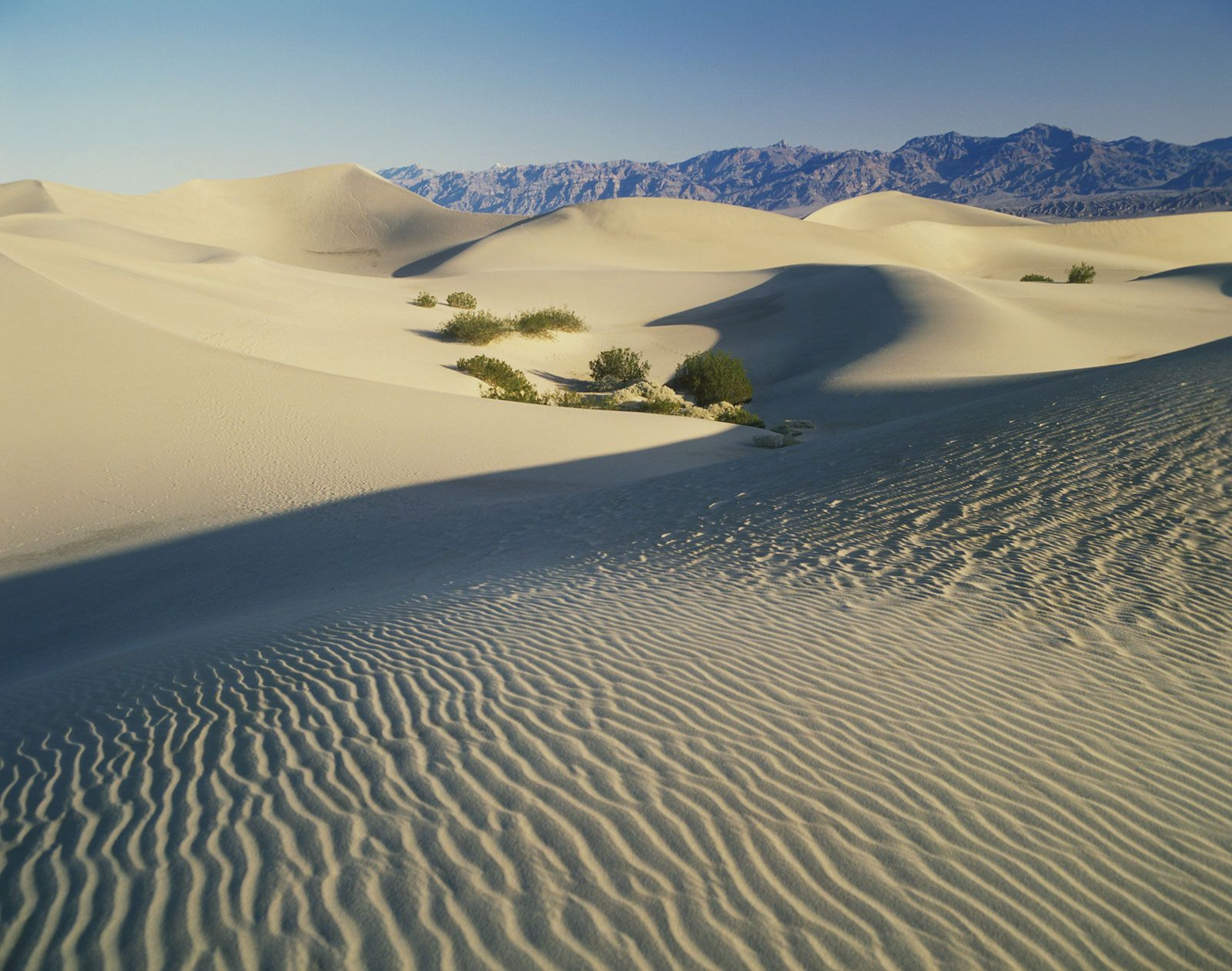
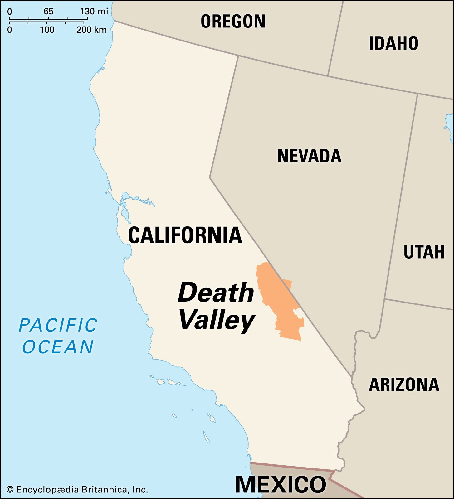
Death Valley, a land of extremes and stark beauty, is situated in southeastern California, United States. More specifically, it lies predominantly within Inyo County, nestled close to the ill-defined boundary separating the Great Basin and the Mojave Desert. This unique geographical position contributes significantly to Death Valley’s distinctive and often record-breaking environmental conditions.
To pinpoint its location further, Death Valley stretches lengthwise in a north-south direction, flanked by notable mountain ranges. To its west rises the Panamint Range, while the Black, Funeral, and Grapevine Mountains of the Amargosa Range delineate its eastern edge. This structural depression, approximately 140 miles (225 km) in length and varying between 5 to 15 miles (8 to 24 km) in width, is not just any valley; it’s a geological marvel renowned for being the lowest, hottest, and driest part of the entire North American continent.
 Panoramic view of Death Valley National Park in southeastern California, showcasing its vast desert landscape
Geologically, Death Valley is integral to the southwestern expanse of the Great Basin, sharing characteristics with other structural basins in the region, yet distinguished by its profound depth. A significant portion of the valley floor, characterized by a vast salt pan, marks the lowest land elevations in the Americas. Remarkably, around 550 square miles (1,425 square km) of Death Valley sits below sea level. Within this area, Badwater Basin claims the title of the lowest point in North America, plunging to 282 feet (86 metres) below sea level. Adding to the dramatic topography, just under 20 miles (30 km) to the west, Telescope Peak ascends to 11,049 feet (3,368 metres), representing the highest point in the vicinity and creating a stunning visual contrast within a short distance.
Historically, Death Valley posed a significant obstacle to pioneer settlers, earning its evocative name from the hardships endured by those attempting to traverse it. Later, it became a hub for borax mining activities. Today, paradoxically, its extreme environment is a major draw for both tourists and scientists, fascinated by its unique and challenging conditions.
The physical environment of Death Valley is defined by its geological history and climatic extremes. The valley’s formation is a complex story of faulting, crustal sinking, and volcanic activity. It is essentially a graben, or rift valley, formed by the sinking of a massive rock section between parallel mountain ranges. This process, known as block faulting, began approximately 30 million years ago, gradually creating the valley trough and the adjacent mountain ranges. As the valley deepened, sediments eroded from the surrounding hills filled it, burying the bedrock floor under as much as 9,000 feet (2,745 metres) of sediment in the central areas. The valley floor continues to experience tilting and sinking.
Death Valley’s climate is notorious for its extreme temperatures and aridity. It holds the record for the highest air temperature ever recorded in the world and North America, reaching a staggering 134 °F (57 °C) in 1913. Summer temperatures frequently soar above 120 °F (49 °C), with ground temperatures reaching as high as 201 °F (94 °C). This intense heat, combined with low humidity, results in exceptionally high evaporation rates. Conversely, winter minimum temperatures are mild, rarely dropping to freezing, with a record low of 15 °F (−9 °C). Rainfall is scarce due to the rain shadow effect of the western mountains. The average annual rainfall at Furnace Creek in the 20th century was a mere 1.66 inches (42.2 mm), with some years experiencing no measurable rainfall at all.
Surface water in Death Valley is limited, primarily found in saline ponds and marshes around the salt pan. The Amargosa River contributes some water from eastern desert regions, mainly through underground flow. Salt Creek, in the northern part of the valley, also has intermittent surface flow. However, geological evidence indicates a much wetter past. During the Wisconsin Glacial Stage of the Pleistocene Epoch, around 50,000 years ago, Lake Manly filled Death Valley to depths of up to 600 feet (180 metres). More recently, a shallower lake existed about 2,000 to 5,000 years ago, whose evaporation led to the formation of the present-day salt pan.
 Detailed map view of Death Valley's geological formations and salt flats in the Mojave Desert
In conclusion, Death Valley’s location in southeastern California, at the junction of the Great Basin and Mojave Desert, dictates its extreme environmental conditions and unique geological features. Its position as the lowest point in North America, coupled with its record-breaking heat and aridity, makes it a truly remarkable and globally significant geographical location, attracting continued scientific interest and tourist visitation.