
Mauritania, officially the Islamic Republic of Mauritania, is a nation located in West Africa. But Where Is Mauritania exactly? Nestled at the crossroads of the Arab Maghreb and sub-Saharan Africa, Mauritania occupies a unique geographical position, characterized by vast deserts and a significant Atlantic coastline. Understanding Mauritania’s location is key to appreciating its diverse landscapes, climate, and cultural influences.
Borders and Location
Mauritania is situated in the northwestern part of Africa. To precisely answer “where is Mauritania”, it is crucial to identify its neighboring countries and key geographical markers. It shares borders with:
- Northwest: Western Sahara
- Northeast: Algeria
- East and Southeast: Mali
- Southwest: Senegal
To its west, Mauritania boasts a 435-mile (700 km) coastline along the Atlantic Ocean, stretching from the Sénégal River delta in the south up to the Cape Nouâdhibou (Cape Blanco) Peninsula in the north. This coastal access has historically been significant for trade and fishing.
Relief and Topography
The landscape of Mauritania is largely shaped by its arid climate. The terrain is predominantly flat, contributing to the expansive feel of the country. Coastal plains are generally low-lying, below 150 feet (45 meters), while inland plains rise to between 600 to 750 feet (180 to 230 meters). These interior plains form a plateau characterized by tablelands and gentle slopes, typically around 2 degrees.
However, the topography isn’t entirely monotonous. Vestiges of cliffs, known as cuestas, and sloping plains ending in steep scarps (sometimes reaching 900 feet or 275 meters) add variation. Inselbergs, isolated steep-sided hills, also dot the landscape. Notably, Mount Ijill, composed of hematite, stands as the highest inselberg at 3,002 feet (915 meters).
Geologically, Mauritania can be segmented into three primary zones. The north and northwest are underpinned by Precambrian rock, dating back approximately 2.7 billion years. This ancient rock forms the Reguibat ridge region in the north and the Akjoujt rock series, creating a peneplain interspersed with inselbergs.
The central and eastern parts of Mauritania, extending slightly into the north, constitute the second zone. In the north, primary sandstone covers the Tindouf Syncline. The central area is dominated by the vast Taoudeni synclinal basin, bordered by the Adrar, Tagant, and ʿAçâba (Assaba) plateaus. The Hodh Depression slightly indents the basin to the south, with the Affollé Anticline at its center.
The third zone is the Senegalese-Mauritanian sedimentary basin, encompassing coastal Mauritania and the lower Sénégal River valley in the southwest.
Drainage Systems
Mauritania’s drainage is irregular, largely due to its arid environment. Normal drainage patterns are mainly observed in the inland southwest, where tributaries of the Sénégal River flow southward. The Sénégal River itself marks the border with Senegal and experiences seasonal flooding during the summer.
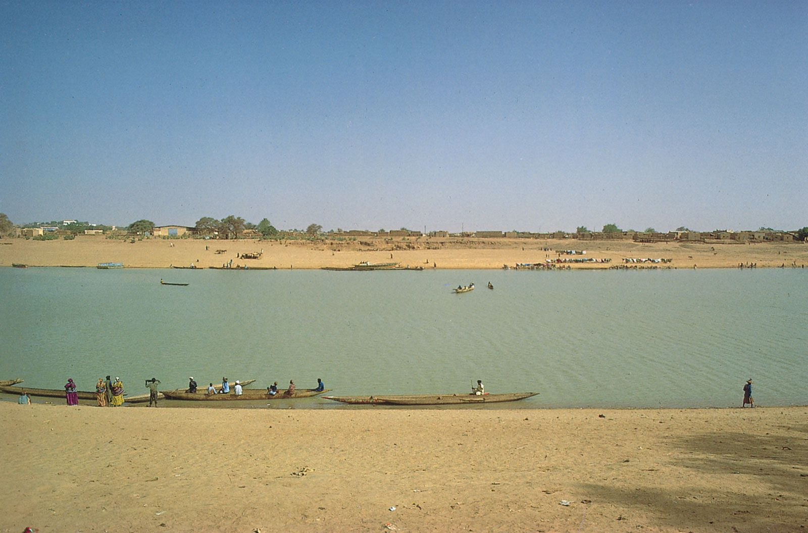 Boats on the Senegal River in Kaédi, Mauritania, showcasing the river's importance for transport and daily life in the region.
In much of the rest of the country, plateaus are dissected by wadis, dry riverbeds that occasionally flood, with water dissipating into permanent drainage basins known as guelt (singular guelta). The northern and eastern regions receive such minimal rainfall that runoff is practically non-existent.
Soil Composition
The soils of Mauritania reflect its long history of aridity during the Quaternary Period. The landscape is characterized by three main soil types: skeletal soils, regs, and dunes.
Skeletal soils are found where underlying rock is slightly weathered or covered by a patina or chalky crust. Saline soils are also present in salt flats, resulting from evaporated lakes. Regs are extensive plains covered with pebbles and boulders. Dunes are the most prominent soil feature, covering approximately half of Mauritania. These dunes form long ridges called ʿalâb, sometimes reaching heights of 300 feet (90 meters), often overlapping to create networks of domes and basins.
Brown soils, containing around 2 percent humus, are found in the southern regions, typical of steppe environments. In the extreme south, iron-bearing lateritic soils, characteristic of the Sudanic zone, begin to appear. Hydromorphic soils, altered by waterborne materials, are also found in the lowest areas.
Climate Zones
Mauritania’s climate is predominantly arid, influenced by the northeastern trade winds, which are constant in the north and prevalent throughout most of the year elsewhere. The drying effect is intensified by the harmattan, a hot, dry wind from the northeast or east.
Rainfall is scarce and primarily occurs due to rain-bearing southwesterly winds in the summer, extending progressively northward. The rainy season and annual precipitation decrease from south to north. Sélibabi in the far south receives about 25 inches (635 mm) of rain between June and October, while Nouâdhibou in the north receives only 1 to 2 inches (25 to 50 mm), typically between September and November. Precipitation often manifests as stormy showers or squalls due to the clash between wet southwesterlies and the harmattan.
High temperatures are typical due to strong sun and lack of haze. Summer afternoon temperatures often reach the low 100s F (high 30s C), with interior highs in the 110s F (40s C) being common. Average temperatures in the coldest month remain in the high 60s F (low 20s C) across most stations, while the hottest month sees averages rising to the mid-70s F (mid-20s C) in Nouakchott (September), high 70s F (mid-20s C) in Kiffa (May), low 80s F (high 20s C) in Atar (July), and mid-80s F (high 20s C) in Néma (May).
In conclusion, Mauritania is located in West Africa, bordered by Western Sahara, Algeria, Mali, and Senegal, with a significant Atlantic coastline. Its geography is characterized by flat, arid landscapes, diverse soil types ranging from dunes to skeletal soils, and a climate that transitions from semi-arid in the south to hyper-arid in the north. Understanding where Mauritania is geographically is crucial for grasping the country’s environmental conditions and regional context within West Africa.