The Netherlands, often interchangeably referred to as Holland, is a captivating country nestled in the northwestern corner of Europe. Known for its iconic windmills, vibrant tulip fields, and rich cultural heritage, understanding the precise location of the Netherlands is key to appreciating its geographical significance and its role in European history and contemporary affairs. This low-lying nation, whose very name translates to “low countries,” boasts a strategic position that has shaped its identity and influence for centuries.
To pinpoint the Netherlands on a map, it occupies a crucial space in Western Europe. It shares borders with Germany to the east, Belgium to the south, and the North Sea washes its northern and western coasts. This positioning places the Netherlands at the heart of continental Europe, acting as a vital gateway between the mainland and the Atlantic Ocean. More specifically, the Netherlands is geographically situated approximately between latitudes 50° and 54° North and longitudes 3° and 7° East. While “Holland” is frequently used to denote the entire country, it technically refers to two of its twelve provinces, namely Noord-Holland (North Holland) and Zuid-Holland (South Holland), which were historically central to the development of the Dutch state.
The geography of the Netherlands is inextricably linked to water. Its famously flat landscape, punctuated by numerous lakes, rivers, and canals, is a testament to the Dutch mastery of water management. A significant portion of the country, roughly 2,500 square miles (6,500 square km), is composed of polder land – land reclaimed from the sea and other bodies of water. This remarkable feat of engineering, dating back to the medieval period, involved draining marshes and lakes, particularly along the extensive river systems, and constructing dikes along the coastline to hold back the sea. Windmills played a crucial role in the initial stages of land drainage, famously exemplified by the network at Kinderdijk-Elshout, now a UNESCO World Heritage site. Later, steam and electric pumps augmented these efforts, facilitating even larger-scale land reclamation projects, particularly in the 19th and 20th centuries.
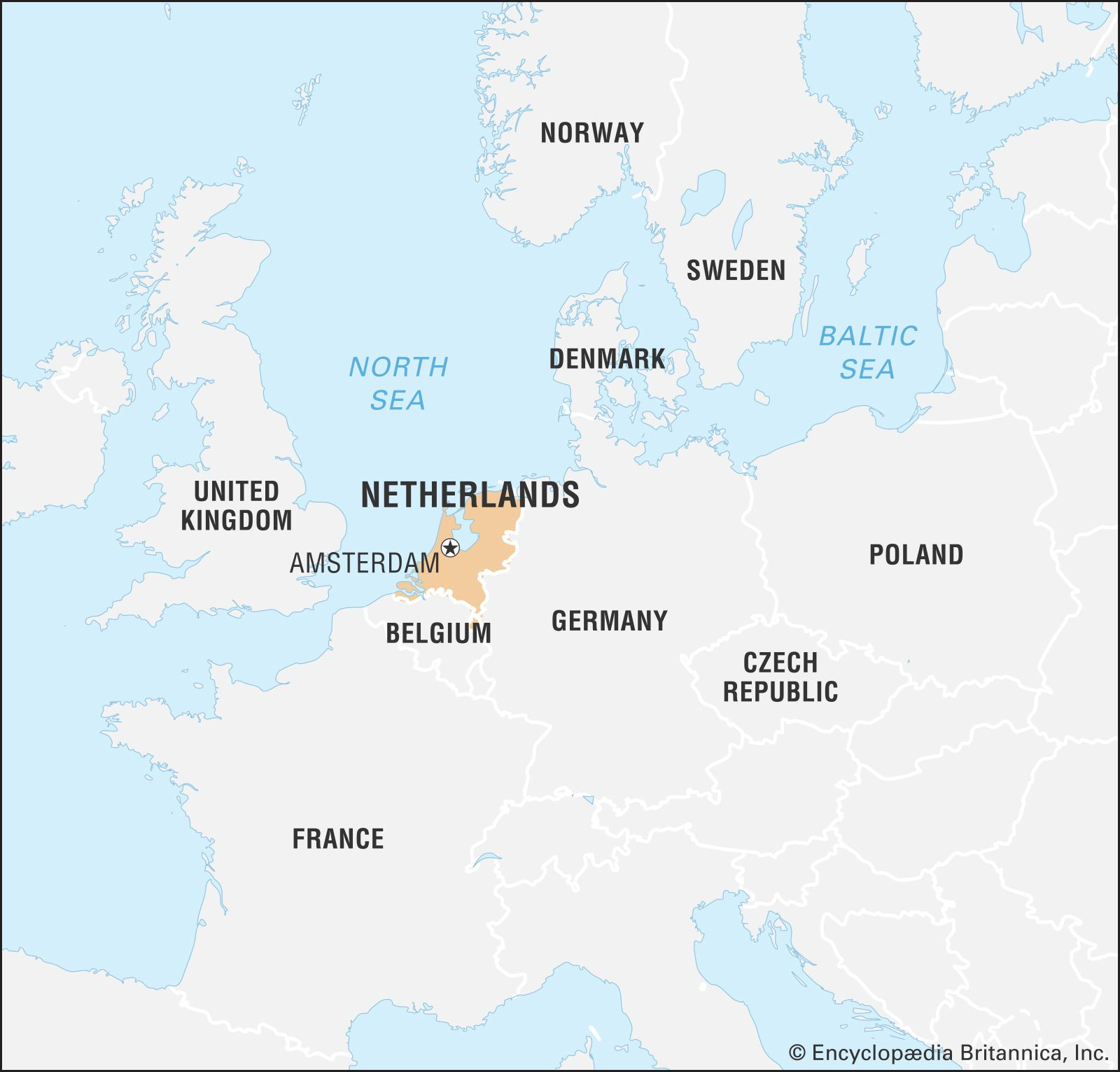 Locator map of Netherlands in Europe, highlighting its position in northwestern Europe
Beyond its European location, the Kingdom of the Netherlands also encompasses territories in the Caribbean. These include the islands of Aruba, Bonaire, Curaçao, Saba, Sint Eustatius, and Sint Maarten, remnants of its colonial past in the Lesser Antilles. However, when discussing the Netherlands geographically in a European context, the focus remains firmly on its northwestern European location.
The Netherlands’ strategic location has been instrumental in its historical and economic development. During the 16th and 17th centuries, often referred to as the Dutch Golden Age, its position facilitated global trade and maritime power. Dutch merchant ships traversed the world, establishing trade routes and contributing to the nation’s wealth and influence. This outward-looking, internationalist perspective remains a defining characteristic of the Netherlands today. It is a founding member of the Benelux economic union (along with Belgium and Luxembourg), which served as a blueprint for the larger European Economic Community, now the European Union (EU). The Netherlands is also a key member of the North Atlantic Treaty Organization (NATO) and the Organisation for Economic Co-operation and Development (OECD), underscoring its commitment to international cooperation and global governance. The Hague, the seat of the Dutch government, further solidifies this international role by hosting numerous international organizations, most notably the International Court of Justice.
Explore the canals and cultural design of Amsterdam, a key city in the Netherlands.
While compact in size, the Netherlands is one of the most densely populated countries in the world. Its major cities, Amsterdam (the capital) and The Hague (the seat of government), are vibrant centers of culture, commerce, and international activity. Amsterdam, in particular, is renowned for its canals, museums, and liberal social atmosphere, attracting visitors and residents from across the globe. This blend of historical significance, geographical ingenuity in managing its landscape, and a forward-thinking, international outlook firmly establishes the Netherlands as a significant player on the European and world stage, far exceeding what its physical size might suggest. Understanding “Where Is Netherlands Located” is therefore just the starting point to appreciating the depth and breadth of this fascinating nation.
Learn more about the flag of the Netherlands and its symbolism.