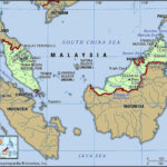
New Guinea, a name that conjures images of lush rainforests, towering mountains, and unique cultures, is an island of immense geographical and ecological significance. But Where Is New Guinea Located? This question is fundamental to understanding its unique characteristics and global importance. Nestled in the southwestern Pacific Ocean, just north of Australia, New Guinea is a crucial part of the Malay Archipelago and a fascinating study in geography, biodiversity, and human history.
To pinpoint New Guinea’s location, it’s essential to understand its broader geographical context. It lies within Melanesia, a subregion of Oceania extending from New Guinea westward to the Arafura Sea, and eastward to Fiji. More specifically, New Guinea is positioned in the eastern reaches of the Malay Archipelago, a vast archipelago largely located in Southeast Asia and Australasia between the Indian and Pacific oceans. This strategic placement between major continents and oceans has shaped its climate, ecosystems, and cultural interactions for millennia.
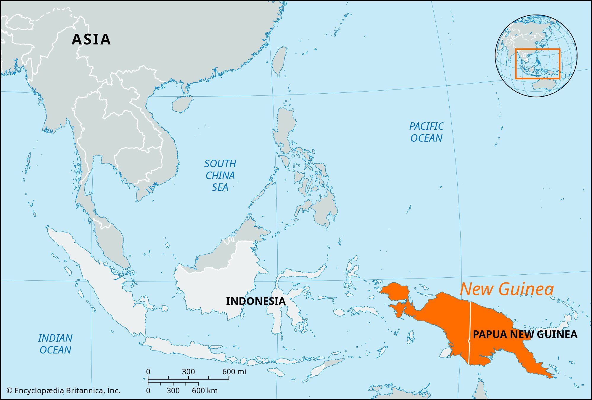 New Guinea Locator Map
The island is bounded by several significant bodies of water. To the north lies the vast expanse of the Pacific Ocean. The Bismarck and Solomon Seas border it to the east, while the Coral Sea and Torres Strait define its southern limits, separating it from the Australian continent. To the southwest, the Arafura Sea completes its maritime boundary. This archipelago setting contributes to New Guinea’s incredible biodiversity and distinct island ecosystems.
Administratively, New Guinea’s location is also defined by its division between two political entities. The western half of the island is integrated into Indonesia, forming the provinces of Papua and West Papua. Collectively, this region was formerly known as Irian Jaya. The eastern half constitutes the major part of the independent nation of Papua New Guinea, which gained independence in 1975. This political division adds another layer to understanding where New Guinea is located in a global context.
Delving into New Guinea’s Land and Geographical Features
New Guinea’s location isn’t just about its coordinates; it’s intrinsically linked to its dramatic landscape. A defining feature is the imposing central mountain range that runs like a spine from northwest to southeast across the island. This chain boasts peaks exceeding 13,000 feet (4,000 meters), culminating in Jaya Peak in West Papua, which soars to 16,024 feet (4,884 meters). Jaya Peak is not only the highest point in New Guinea but also the highest summit in Indonesia, showcasing the island’s significant altitude. These mountains feature glaciers, extinct volcanoes, and fertile highland basins, creating diverse habitats within a relatively small geographical area.
North of this central range, a structural trench carves through the land, hosting the valleys of major rivers like the Mamberamo, Sepik, Ramu, and Markham. Further north, fault-rimmed mountains rise along the coast, though generally lower than the central range. In the northwest, the Bomberai and Doberai Peninsulas extend outwards, adding further geographical complexity to New Guinea’s location.
South of the central mountains lies the Fly-Digul shelf, a stark contrast to the highlands. This vast, swampy plain is crisscrossed by numerous rivers, including the Fly, Bian, Digul, Mapi, Pulau, and Lorentz. To the southeast, the Owen Stanley Range stretches out, forming a peninsula that separates the Solomon Sea from the Coral Sea, further emphasizing New Guinea’s location as a divider between major marine environments.
Climate and Biodiversity Influenced by Location
New Guinea’s equatorial location dictates a predominantly tropical climate. Lowland areas experience consistently high temperatures, typically between 86 and 90 °F (30 and 32 °C). Even in the highlands, daytime temperatures generally exceed 72 °F (22 °C) year-round. The southeast trade winds bring significant rainfall, particularly to the southern slopes of the central highlands, which can receive over 300 inches (7,620 mm) of rain annually. This makes the Fly-Digul shelf and adjacent highlands among the wettest places on Earth, contributing to its sparse population density. The central highlands receive substantial rainfall throughout the year, while areas like Port Moresby on the southeastern coast are considerably drier.
This tropical climate, combined with New Guinea’s unique location and varied topography, fosters an extraordinary array of plant and animal life. The island is renowned for its biodiversity, including orchids, figs, and diverse rainforest species. Mangrove swamps fringe much of the coastline, transitioning inland to nipa palm stands and sago palm forests along southern deltas and rivers. Lowland rainforest dominates up to around 3,300 feet (1,000 meters), giving way to oak, beech, and pine forests in the central highlands. Wildlife is equally diverse, with numerous reptiles, marsupials like tree kangaroos and phalangers, and iconic birds such as cassowaries and birds of paradise.
People and Economy Shaped by Geographical Context
The indigenous population of New Guinea is largely composed of speakers of Papuan languages, believed to be the island’s original settlers, residing mainly in the interior and southern regions. Coastal areas and offshore islands are also home to communities speaking Austronesian (Melanesian) languages, reflecting migrations and interactions over centuries. The linguistic diversity is staggering, with approximately 700 different languages spoken across the island, highlighting the isolation and unique cultural development within different geographical pockets of New Guinea’s location.
Economically, New Guinea’s location and natural resources play a significant role. Subsistence farming is widespread, with staple crops varying by region – yams, taro, sago, and bananas in the lowlands, and sweet potatoes in the highlands. Pig husbandry is also common. The island is rich in mineral resources, particularly copper and gold, with major deposits like Tembagapura and Ok Tedi being globally significant. Petroleum and natural gas are also extracted, contributing to the economy. Cash crops in Papua New Guinea include coffee, cacao, copra, palm oil, tea, and rubber, alongside exports of tuna, prawns, and timber. Internal transport is challenging due to the terrain, relying on coastal roads, riverboats, and increasingly, airways.
Historical Significance of New Guinea’s Position
New Guinea’s location has been pivotal throughout history. Possibly inhabited as early as 50,000 years ago, the island witnessed early agricultural practices around 7000 BCE in its highland basins. Asian seafarers were aware of the island centuries before Europeans. The Portuguese first sighted it in 1511, with landings beginning in 1527.
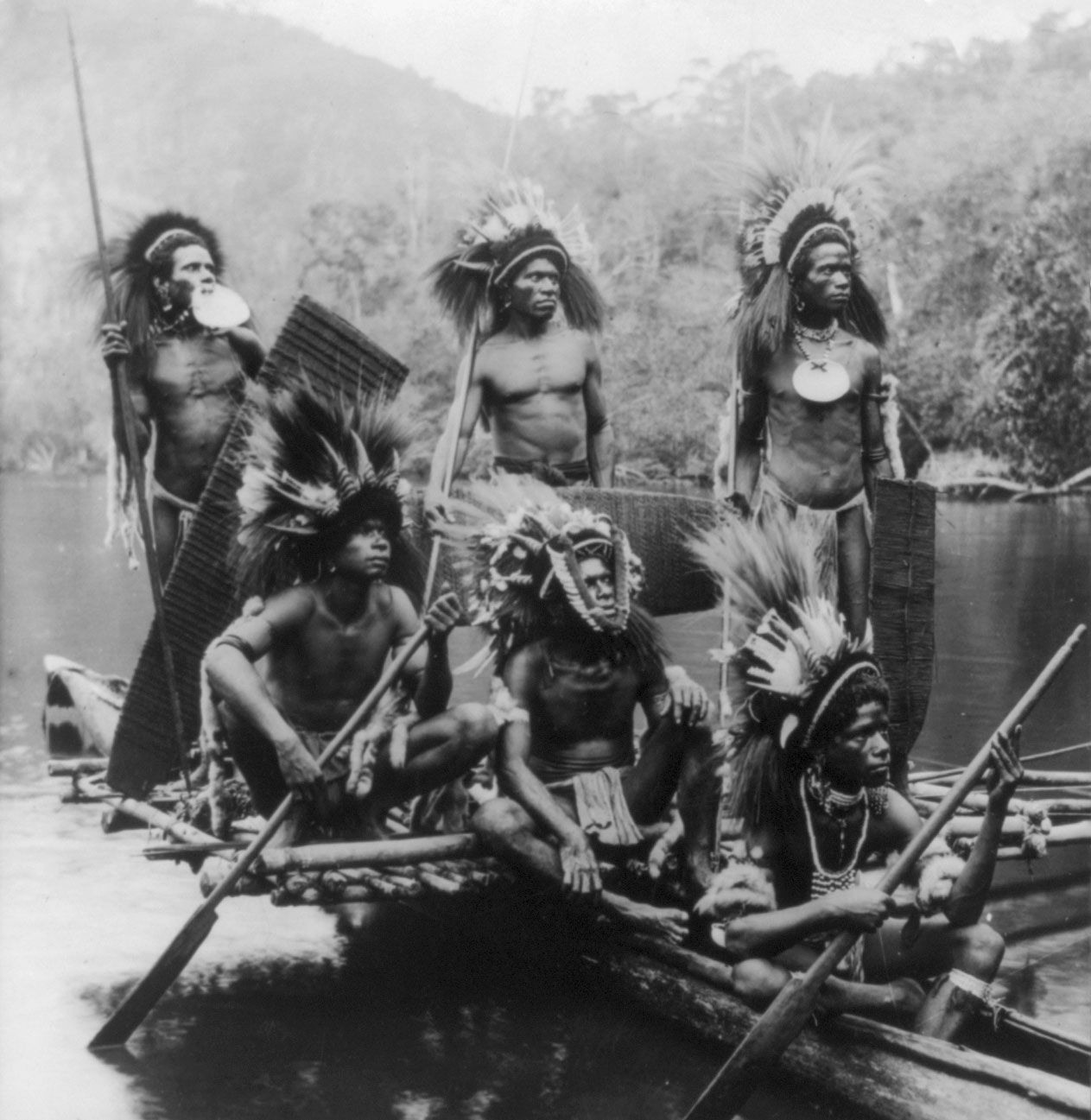 Warriors in Outrigger Canoe, New Guinea, c. 1919
Colonial claims began in the 19th century, with the Dutch claiming the western half in 1828, and Great Britain and Germany annexing portions of the eastern half in 1884. Australia later took over administration of British and German territories. During World War II, Japan occupied parts of the island, leading to significant battles. Post-war, the western half remained under Dutch control before being annexed by Indonesia, while the eastern half became independent Papua New Guinea. This complex history of exploration, colonization, and conflict is deeply intertwined with New Guinea’s strategic location.
In conclusion, where is New Guinea located? It is geographically positioned in the southwestern Pacific Ocean, north of Australia, within the Malay Archipelago and Melanesia. This location dictates its tropical climate, extraordinary biodiversity, diverse cultures, and significant historical trajectory. As the second-largest island in the world, New Guinea’s location is not just a matter of coordinates; it is a key to understanding its global significance in ecology, anthropology, and geopolitics.