
Rome, a city synonymous with history, culture, and architectural marvels, has stood as a beacon of civilization for millennia. From its ancient origins as the heart of a vast empire to its modern-day status as the capital of Italy and a major global city, Rome’s location has been pivotal to its enduring influence. But where is Rome exactly? Let’s delve into the geographical details that define this iconic metropolis.
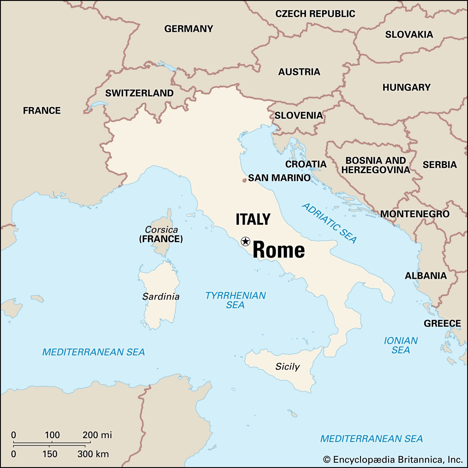
Nestled in the central-western part of Italy, Rome graces the region of Lazio, formerly known as Latium. More precisely, it lies within the Roma province. Geographically, Rome is situated on the Italian Peninsula, a boot-shaped landmass extending into the Mediterranean Sea from Southern Europe. Looking at a map of Italy, Rome is positioned roughly in the middle of the peninsula’s western coastline.
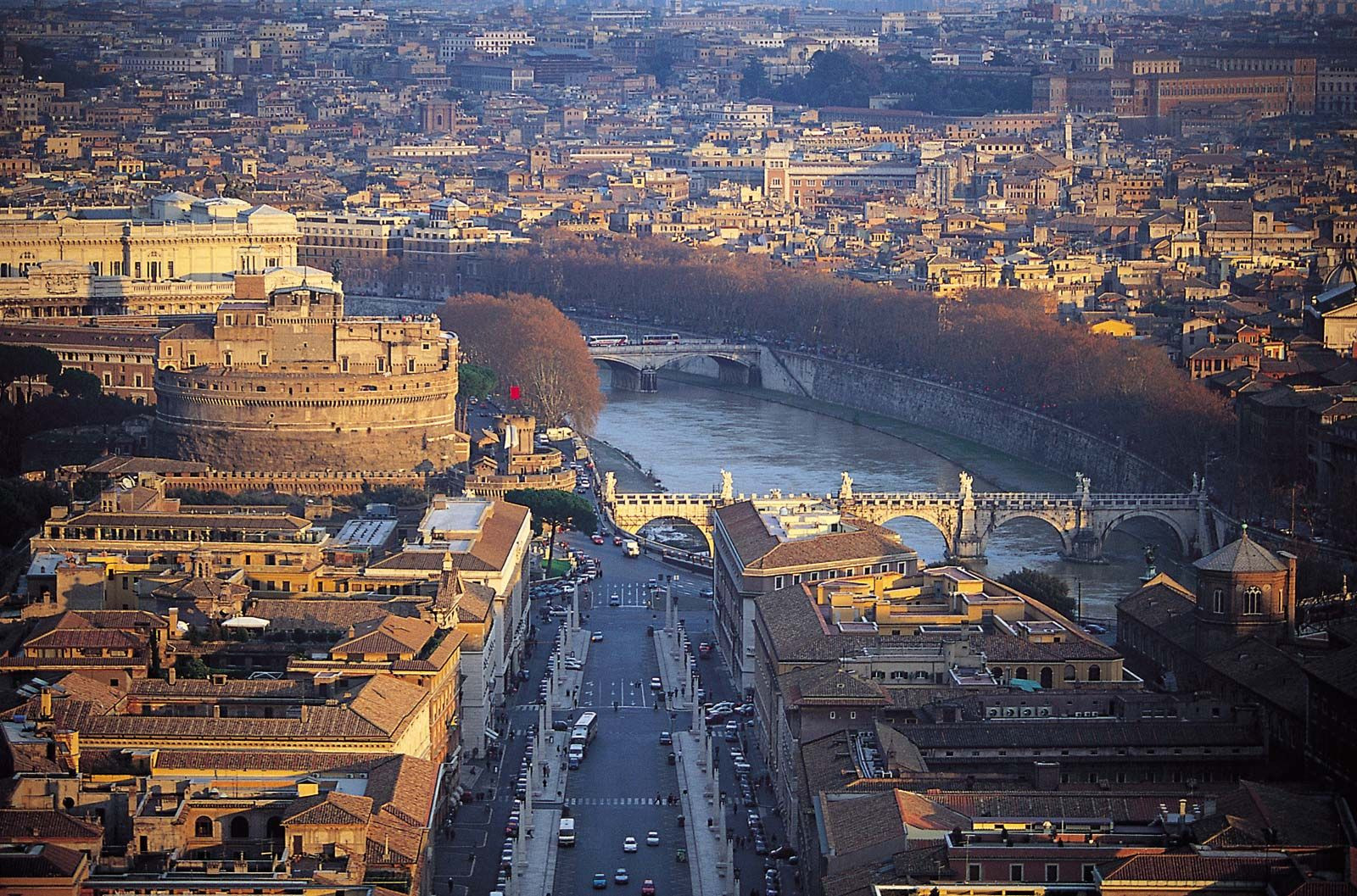 Aerial view of Rome, Italy
Rome’s proximity to significant geographical features has shaped its development and history. The city is built upon the banks of the Tiber River (Fiume Tevere), Italy’s third-longest river. This river has been a vital resource for Rome throughout its existence, providing fresh water, transportation routes, and contributing to the fertile plains surrounding the city. Rome’s location is approximately 15 miles (24 kilometers) inland from the Tyrrhenian Sea, a part of the Mediterranean Sea bordering the western coast of Italy. This coastal proximity offered both strategic advantages for trade and defense, as well as access to maritime resources.
The city’s geographical coordinates further pinpoint its location: approximately 41.9028° N latitude and 12.4964° E longitude. This places Rome within the temperate climate zone, characterized by mild, wet winters and hot, dry summers – a climate that has favored human settlement and agricultural prosperity for centuries.
Rome’s location has been strategically important throughout history. In ancient times, its central position in the Italian peninsula facilitated its rise as a dominant power. Its location on the Tiber River, with its access to the sea yet protected inland position, offered advantages for trade, communication, and defense. The seven hills of Rome, around which the ancient city developed, provided natural fortifications and vantage points.
 Rome, Italy cityscape showcasing historical architecture
In modern times, Rome’s central location within Italy continues to be significant. As the nation’s capital, it serves as the political, administrative, and cultural heart of the country. Its location is easily accessible from other major Italian cities and European centers via extensive transportation networks, including highways, railways, and two international airports. This accessibility reinforces Rome’s role as a major hub for tourism, business, and international relations.
Furthermore, Rome’s location within the Lazio region places it in a landscape of rolling hills, volcanic lakes, and fertile plains. The surrounding countryside offers a blend of natural beauty and agricultural richness, complementing the urban environment of the city itself. This geographical diversity contributes to the region’s appeal and economic activity.
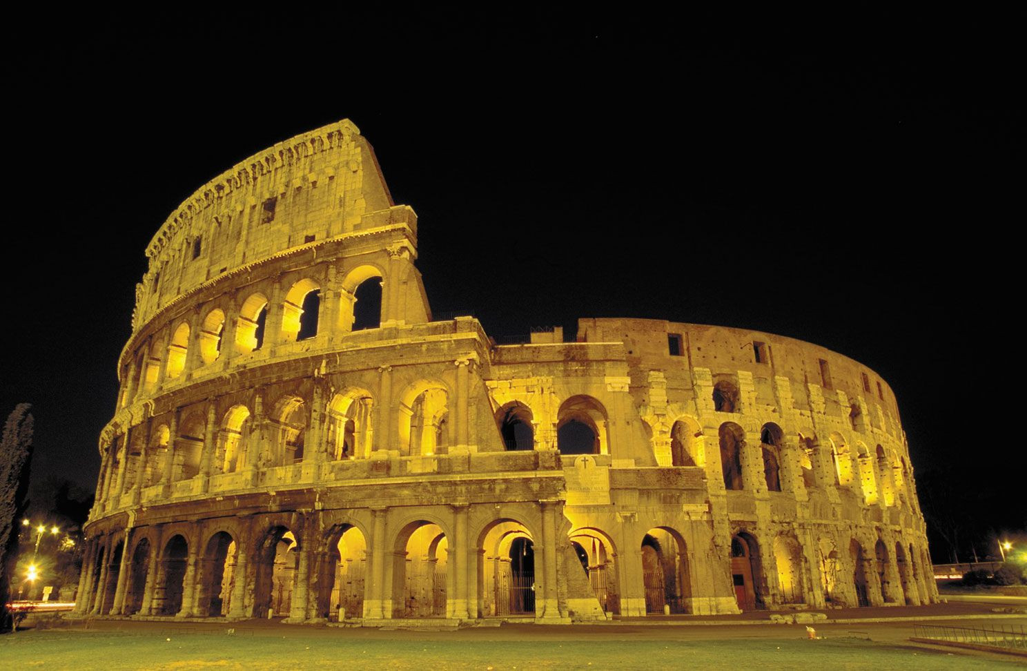 The Colosseum in Rome, Italy, showcasing ancient Roman architecture
In conclusion, Rome is located in the central-western part of Italy, in the Lazio region, on the banks of the Tiber River, and approximately 15 miles inland from the Tyrrhenian Sea. Its geographical coordinates are approximately 41.9028° N, 12.4964° E. This strategic location has been fundamental to Rome’s historical significance, its enduring cultural influence, and its continued importance as a major global city. Understanding Where Rome Is geographically provides a crucial foundation for appreciating its rich history and vibrant present.