Prussia is a name that echoes through European history, conjuring images of military might, royal dynasties, and significant geopolitical shifts. But Where Was Prussia exactly? Understanding Prussia’s location is key to grasping its profound impact on the continent’s past and its lasting legacy. This article delves into the geographical and historical context of Prussia, tracing its evolution across centuries and clarifying its position on the map of Europe.
The Original Lands of Prussia on the Baltic Coast
The story of Prussia begins in the southeastern corner of the Baltic Sea. This region, inhabited by the Old Prussians, a Baltic people related to modern-day Latvians and Lithuanians, forms the initial answer to “where was Prussia”. These early Prussians lived in tribal communities across a landscape of forests and rivers, roughly situated between the Vistula and Neman Rivers. Their pagan beliefs and decentralized social structure contrasted with the rising Christian powers around them.
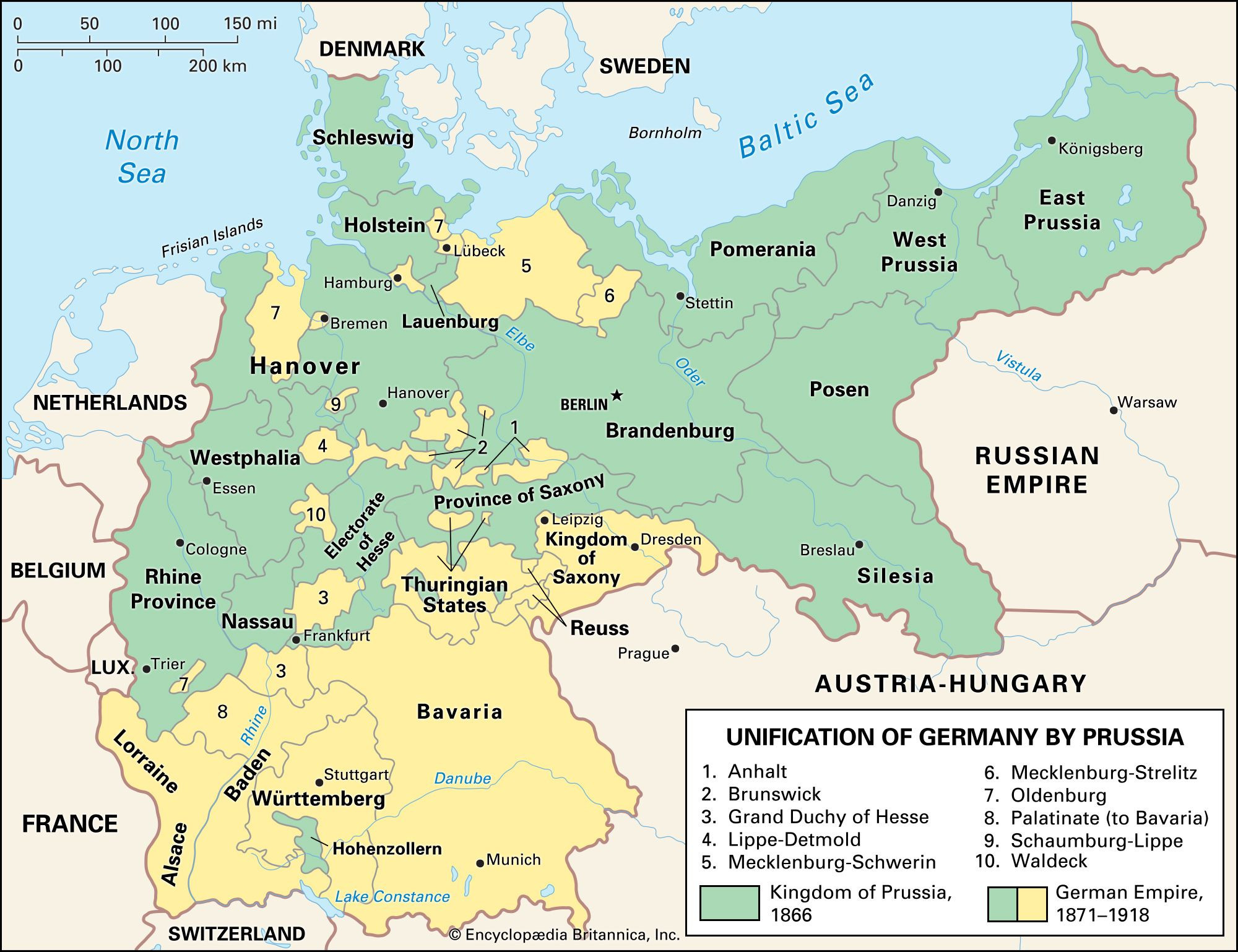 Map illustrating the Unification of Germany led by Prussia, highlighting the expansion of Prussian territory across north-central Europe to form the German Empire.
This area, known historically as Prussia, faced increasing pressure from neighboring Poland. In the 13th century, the Teutonic Knights, a German-speaking crusading order, were invited by Polish Duke Conrad of Mazovia to help defend against Prussian incursions. This marked a turning point. The Teutonic Knights, instead of just assisting, conquered and Christianized the Prussians, establishing their own state. German settlers followed, gradually shifting the linguistic and cultural landscape of the region. By the 14th century, German speakers became the majority, though Old Prussian language persisted for some time.
The Rise of Brandenburg-Prussia and Territorial Expansion
The geographical identity of Prussia became more complex with the rise of the Hohenzollern dynasty. The Teutonic Order’s state, located in what became known as East Prussia, eventually came under Polish sovereignty in part, following conflicts and treaties. However, a pivotal moment occurred when Albert of Hohenzollern, the last Grand Master, converted to Lutheranism in 1525 and secularized the Teutonic Order’s Prussian territories into Ducal Prussia.
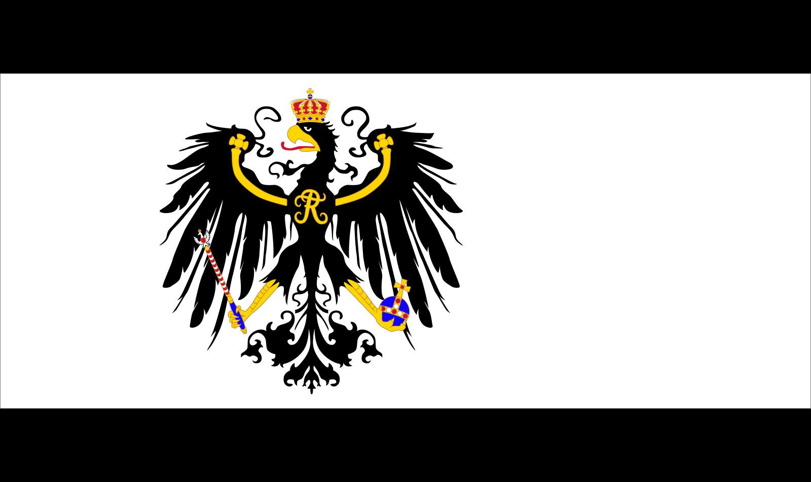 The flag of the Kingdom of Prussia, featuring the black eagle emblem, flown from 1892 to 1918, symbolizing Prussian identity and history.
Ducal Prussia’s fate intertwined with Brandenburg, a territory centered around Berlin. When Albert Frederick, the son of Albert, died without a male heir in 1618, Ducal Prussia passed to John Sigismund, the Hohenzollern Elector of Brandenburg, through marriage. This personal union of Brandenburg and Ducal Prussia was crucial. It laid the foundation for a powerful state that would eventually be known simply as Prussia, even though its heartland was now geographically split between Brandenburg and East Prussia.
Over the next centuries, Brandenburg-Prussia, under rulers like the Great Elector Frederick William and later King Frederick I, consolidated power and expanded its territories. Through military strength and strategic diplomacy, Prussia gained full sovereignty over Ducal Prussia, previously a Polish fiefdom. Frederick I achieved the title of “King in Prussia” in 1701, elevating Prussia’s status on the European stage. This Kingdom of Prussia then became the driving force behind further territorial gains, primarily at the expense of its neighbors, including Poland and Austria.
Key Geographical Areas of the Kingdom of Prussia
To pinpoint “where was Prussia” during its height as a kingdom, we need to consider its diverse territorial components:
- Brandenburg: The electoral march with Berlin as its center, formed the core of Hohenzollern power. Berlin became the capital of the Kingdom of Prussia.
- East Prussia: Originally Ducal Prussia, this region remained geographically distinct, separated from Brandenburg by Polish territories for a significant period. Königsberg (now Kaliningrad) was its main city and the site of Frederick I’s coronation.
- West Prussia: Acquired from Poland in the First Partition of 1772, West Prussia connected East Prussia with Brandenburg, creating a more contiguous Prussian realm.
- Pomerania: Parts of Western Pomerania were gained through wars, providing Prussia with Baltic Sea coastline west of the original Prussian lands.
- Silesia: Seized from Austria by Frederick the Great in the 18th century, Silesia was a wealthy and strategically important province, significantly boosting Prussia’s resources and prestige.
- Rhineland and Westphalia: Acquired later, particularly after the Napoleonic Wars, these western territories extended Prussia’s reach into the Rhineland and increased its influence in western Germany.
Therefore, “where was Prussia” is not a simple answer of a single, static location. Historically, Prussia expanded from its Baltic origins to encompass a significant portion of northern and central Europe. It stretched across a considerable swathe of modern-day Germany, Poland, and parts of Russia, Lithuania, and other neighboring countries.
Prussia’s Central Role in German Unification
Prussia’s geographical position and military strength were instrumental in the 19th-century unification of Germany. Under the leadership of Prussian Minister President Otto von Bismarck, Prussia spearheaded the process, incorporating numerous German states into a unified German Empire in 1871. Berlin, the Prussian capital, became the capital of the German Empire. While the German Empire encompassed much more than just Prussia, Prussia remained its dominant component, both territorially and politically.
The Dissolution of Prussia in the 20th Century
After World War I, the German monarchy was abolished, and Prussia became a state within the Weimar Republic. This “Free State of Prussia” was significantly reduced in size due to territorial losses after the war. However, the final chapter for Prussia as a political entity came after World War II. In 1947, the Allied Control Council officially declared the abolition of the State of Prussia. This decision was part of the post-war reorganization of Germany and aimed to dismantle any vestiges of Prussian militarism and its association with German aggression.
Today, when asking “where was Prussia”, we are referring to a historical entity that no longer exists as a political unit. Its former territories are now distributed across several modern nations, primarily Germany and Poland. East Prussia, for example, is divided between Poland and Russia (Kaliningrad Oblast). Brandenburg is a state within modern Germany, with Berlin as its capital. Silesia is largely within Poland, with smaller parts in Germany and the Czech Republic.
Conclusion: Tracing Prussia’s Shifting Location Through History
In conclusion, answering “where was Prussia” requires understanding its dynamic historical geography. It began as a region on the southeastern Baltic coast, expanded through Brandenburg-Prussia across northern and central Europe, and ultimately dissolved in the aftermath of World War II. While Prussia no longer appears on contemporary maps, its historical footprint remains deeply embedded in the geography and political landscape of Europe. From its Baltic origins to its central role in German unification and its eventual dissolution, Prussia’s story is a complex narrative of shifting borders, evolving identities, and enduring historical significance.