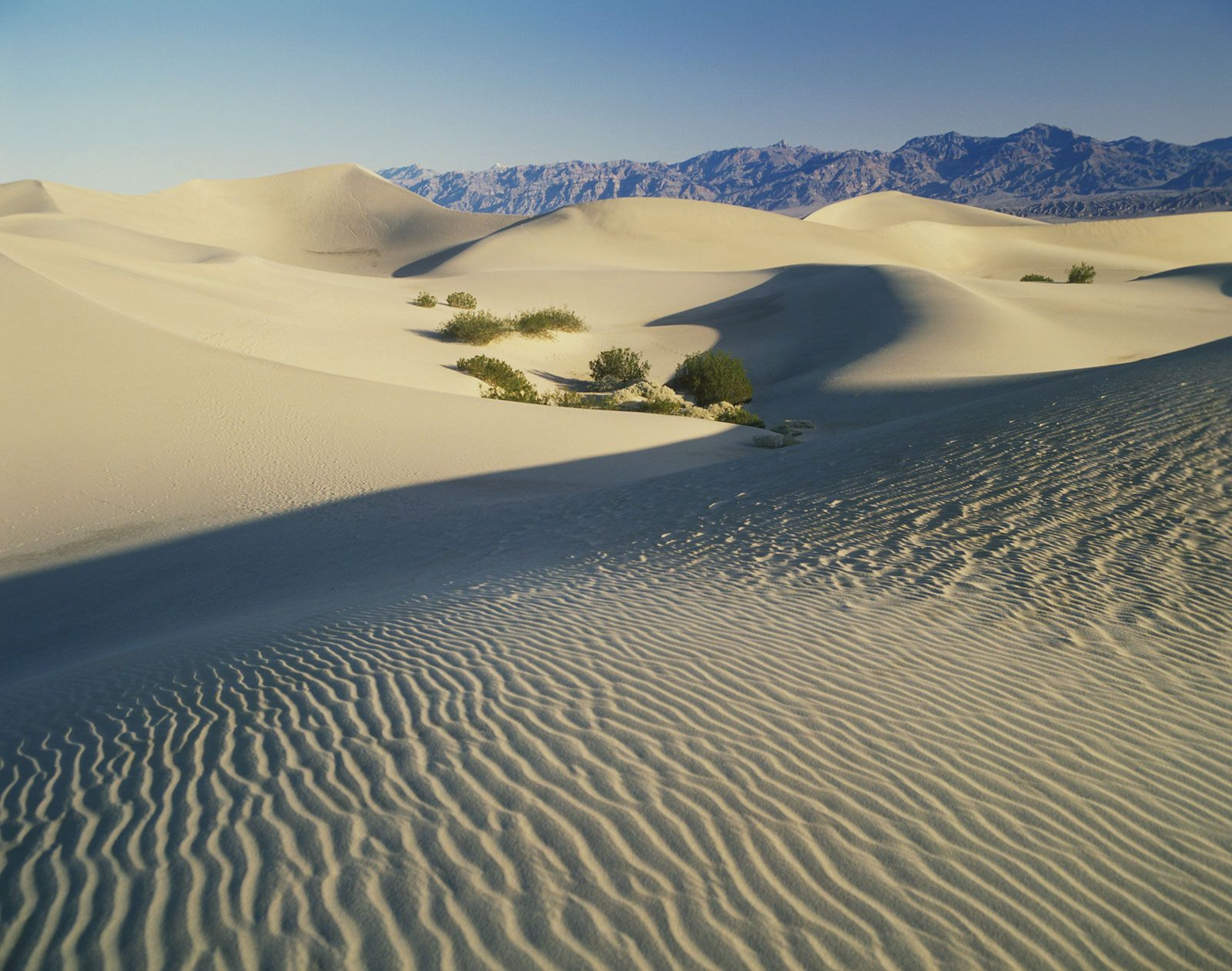
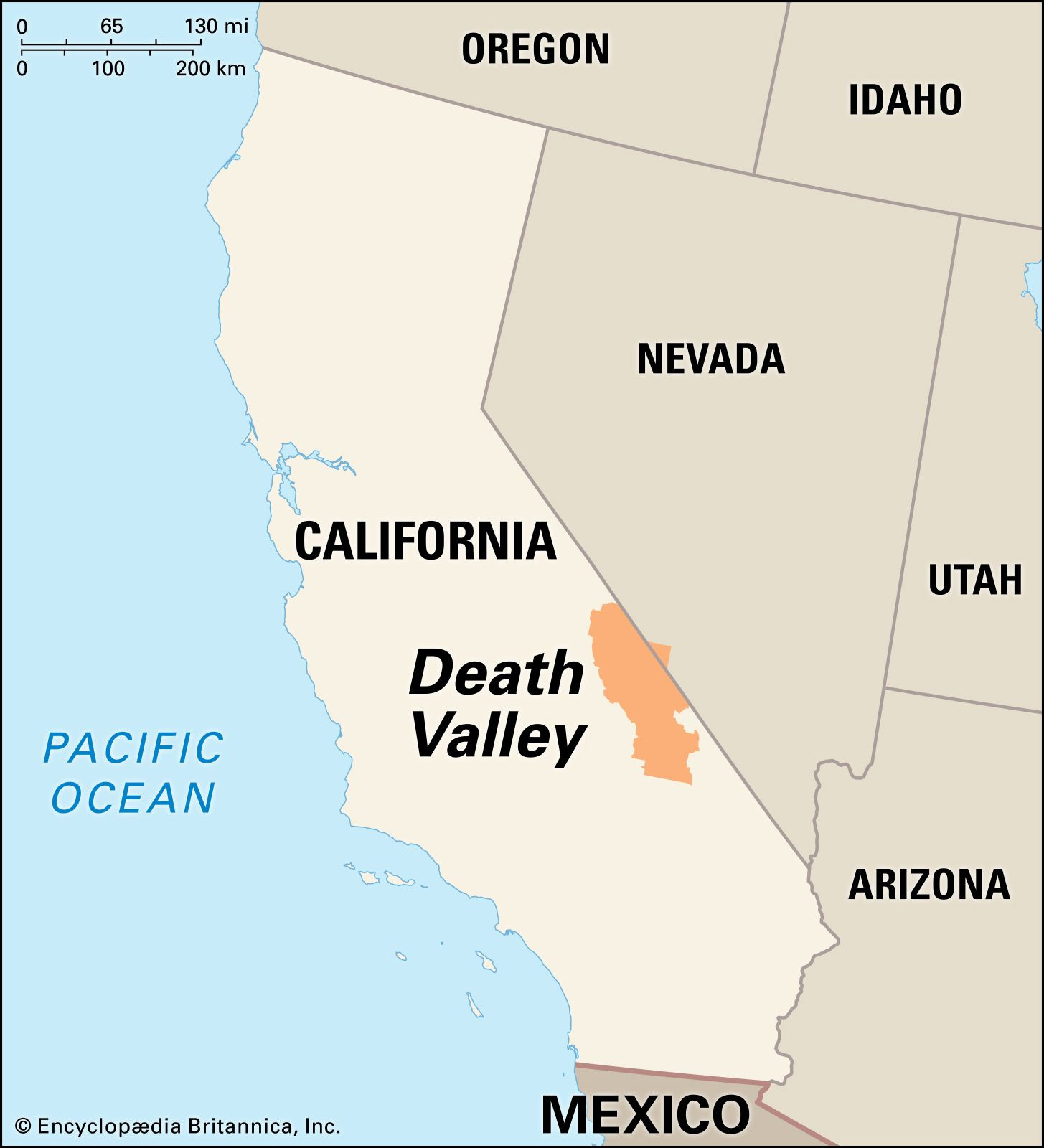
Death Valley, a land of stark contrasts and breathtaking scenery, holds a unique place in the geography of North America. Renowned for its extreme conditions, it is a place of superlatives: the hottest, driest, and lowest national park in the United States. But Where Is Death Valley exactly? This remarkable depression is nestled in southeastern California, offering a landscape unlike any other on the continent.
 Death Valley National Park in the Great Basin, California
Geographical Location and Boundaries of Death Valley
To pinpoint where is Death Valley, we must look to the southeastern region of California. More specifically, it resides primarily within Inyo County. Its elongated shape stretches for approximately 140 miles (225 kilometers) in a north-south direction, with a width varying between 5 to 15 miles (8 to 24 kilometers).
California Setting
Death Valley’s location within California places it in a region known for diverse landscapes, from towering mountains to expansive deserts. While often perceived as isolated, it is accessible, attracting adventurers and nature enthusiasts from across the globe.
Great Basin and Mojave Desert
The valley’s geographical position is further defined by its proximity to two significant North American deserts. Death Valley sits near the ill-defined boundary separating the Great Basin and the Mojave Desert. This transitional location contributes to its unique ecosystem and climate. It shares characteristics with both desert environments, creating an even more extreme and specialized habitat.
Surrounding Mountain Ranges
Framing this remarkable valley are imposing mountain ranges that contribute to its dramatic topography and climate. To the west, the Panamint Range rises sharply, while the Black, Funeral, and Grapevine mountains of the Amargosa Range delineate its eastern edge. These natural barriers play a crucial role in creating Death Valley’s arid conditions by blocking moisture from reaching the valley floor.
 Panoramic view of Death Valley landscape
Extreme Conditions Defining Death Valley’s Location
Where is Death Valley is intrinsically linked to its extreme environmental features. Its location contributes directly to its status as the lowest, hottest, and driest place in North America.
Lowest Elevation
Geologically, Death Valley is part of the southwestern Great Basin, sharing similarities with other basins in the region but distinguished by its exceptional depth. A significant portion of the valley floor, roughly 550 square miles (1,425 square kilometers), lies below sea level. Badwater Basin, within Death Valley, marks the absolute lowest point in North America, plunging to 282 feet (86 meters) below sea level. This remarkable depression accentuates the valley’s extreme nature. In stark contrast, just a short distance west, Telescope Peak soars to 11,049 feet (3,368 meters), illustrating the dramatic vertical relief within a small geographical area.
Hottest Temperatures
Death Valley’s location in a deep, enclosed basin, surrounded by mountains, traps heat, leading to extraordinarily high temperatures. The valley holds the record for the highest air temperature ever recorded on Earth – a staggering 134 °F (57 °C) in 1913. Summer temperatures routinely climb above 120 °F (49 °C), and ground temperatures can reach an astonishing 201 °F (94 °C). The intense heat and low humidity result in extremely high evaporation rates, further contributing to the arid landscape.
Arid Climate
The mountain ranges surrounding Death Valley act as a rain shadow, intercepting most of the moisture coming from the west. This geographical factor results in an exceptionally dry climate. The average annual rainfall at Furnace Creek is incredibly low, averaging only 1.66 inches (42.2 mm) during a 50-year period in the 20th century. Some years experience no measurable rainfall at all, emphasizing the extreme aridity that defines Death Valley.
A History Shaped by Extremes in Death Valley
The harsh conditions of where Death Valley is have profoundly influenced its history, from its early exploration to its modern appeal.
Early Exploration and Naming
The name “Death Valley” itself is a testament to its formidable nature. It was christened in 1849 by a group of pioneers who endured immense hardship while crossing the valley. However, long before European explorers, Native American tribes, primarily the Shoshone, inhabited the area, possessing deep knowledge of how to survive in this challenging environment. Scientific exploration began later, with initial geological observations recorded in 1868.
Mining Era and Ghost Towns
The late 19th and early 20th centuries saw bursts of activity in Death Valley driven by mineral discoveries. Gold, silver, and notably borax deposits attracted prospectors and mining operations. The Harmony Borax Works (1883–88) became famous for the iconic 20-mule teams that hauled borax across the desert. This era left behind numerous ghost towns like Rhyolite, remnants of boom-and-bust cycles fueled by mining ventures. These deserted settlements stand as silent witnesses to the area’s harsh yet resource-rich environment.
Modern Tourism and Scientific Interest
Today, Death Valley’s extreme environment, once a deterrent, now serves as a major attraction. Tourists from around the world are drawn to its unique landscapes and the challenge of experiencing its extreme conditions. Scientists, too, find Death Valley a valuable natural laboratory for studying geology, climate science, and adaptation to harsh environments. The very factors that made it a barrier to early settlers now make it a place of fascination and scientific inquiry.
The Unique Geology of Death Valley
Where Death Valley is also dictates its fascinating geological history. The valley’s formation is a result of complex geological processes spanning millions of years.
Formation as a Graben
Death Valley is fundamentally a graben, or rift valley, created by the sinking of a massive block of land between parallel mountain ranges. This process, known as block faulting, began approximately 30 million years ago. Vertical movements along faults caused the valley floor to drop, while adjacent blocks were uplifted, forming the surrounding mountains.
Sedimentation and Depth
As the valley subsided, it became a basin for accumulating sediments eroded from the nearby hills. Over millennia, this process filled the valley to an immense depth. In the central part of Death Valley, the bedrock floor is buried under as much as 9,000 feet (2,745 meters) of sediment. The valley continues to be geologically active, with ongoing tilting and sinking contributing to its ever-evolving landscape.
In conclusion, where is Death Valley is more than just a geographical question; it is key to understanding its extreme character and unique appeal. Located in southeastern California, nestled between the Great Basin and Mojave Desert, and framed by imposing mountain ranges, Death Valley’s location dictates its status as North America’s hottest, driest, and lowest point. This extraordinary location has shaped its history, environment, and continues to draw people to experience its stark and stunning beauty.
