Luxembourg, officially the Grand Duchy of Luxembourg, is a small landlocked country nestled in the heart of Western Europe. Often considered one of Europe’s hidden gems, understanding where Luxembourg is in Europe is key to appreciating its unique geographical context and charm. This article will delve into the geographical location of Luxembourg, exploring its regions, climate, and distinctive landscapes.
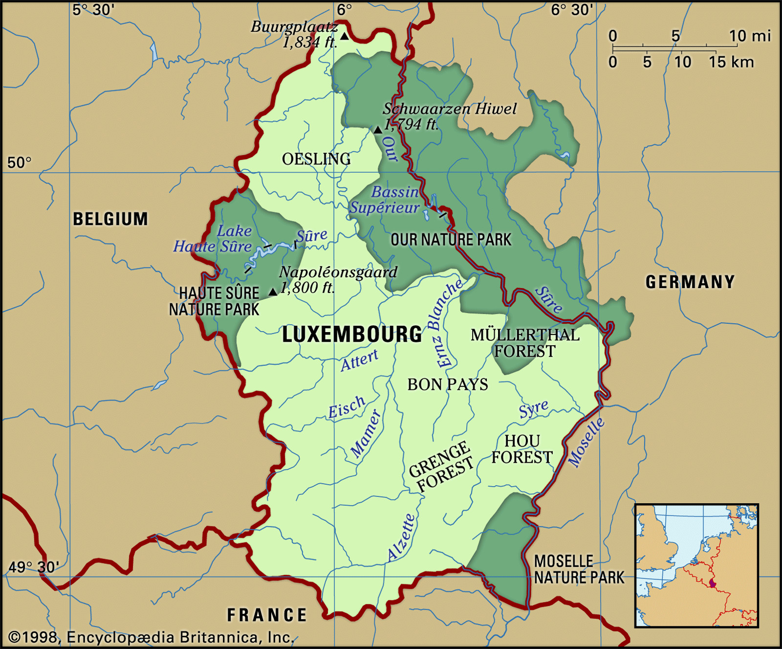
Luxembourg is strategically positioned in Western Europe, bordered by several prominent countries. To the east, it shares a border with Germany, while France lies to the south. Belgium completes its neighboring countries to the west and north. This central location has historically placed Luxembourg at the crossroads of European culture and trade, contributing to its multilingualism and diverse influences.
Geographically, Luxembourg can be divided into two main regions: the Oesling in the north and the Gutland (Bon Pays) in the south. These regions offer contrasting landscapes that shape the country’s character.
The northern third of Luxembourg is known as the Oesling, a part of the Ardennes Mountains that extends from southern Belgium. This region is characterized by a plateau with an average elevation of 1,500 feet (450 meters). The terrain is composed of schists and sandstones, resulting in a rugged, forested highland.
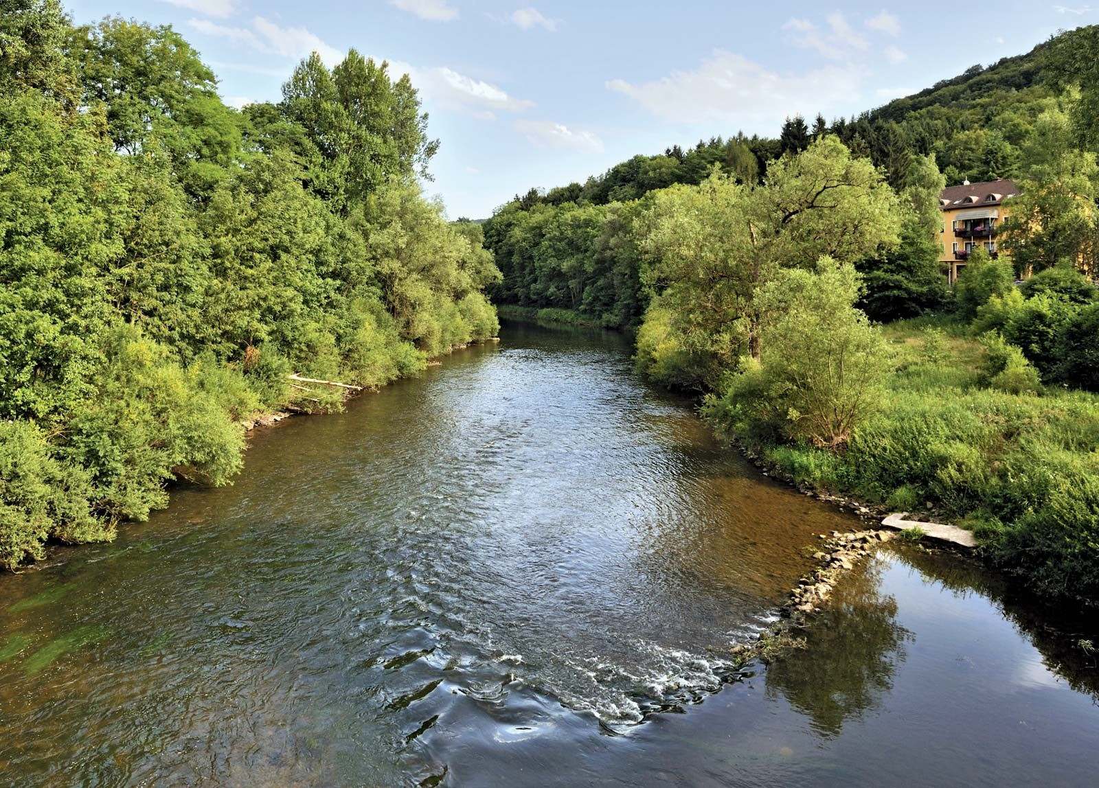
 Luxembourg landscape with forests and hills
The Oesling is incised by deep river valleys, primarily formed by the Sûre River and its tributaries. The Sûre River flows eastward through north-central Luxembourg, eventually meeting the Moselle River on the German border. This network of rivers contributes to the picturesque landscape of the Oesling, dotted with forests and the ruins of historic castles, making it a popular destination for tourists seeking natural beauty and historical exploration. Despite its scenic appeal, the mountain soils in the Oesling are relatively thin, although their fertility was significantly improved in the late 19th century with the introduction of basic-slag fertilizer from the local steel industry.
In contrast to the Oesling, the southern two-thirds of Luxembourg is known as the Bon Pays, or Gutland, meaning “Good Land.” This region presents a more varied topography with an average elevation of 800 feet (approximately 245 meters). As its name suggests, the Bon Pays is more fertile and densely populated than the Oesling. It is home to Luxembourg City, the capital, and other industrial centers like Esch-sur-Alzette.
 Sûre River forming the border between Luxembourg and Germany
The Bon Pays is structured around the valley of the Alzette River, which flows northward and acts as a central axis for the country’s economic activities. Luxembourg City itself is situated along the Alzette River, before it joins the Sûre further north. East of the Bon Pays, the Müllerthal region is notable for its extensive beech forests and sandstone formations, creating a unique ruiniform topography. Luxembourg’s eastern border with Germany is naturally defined by the Our, Sûre, and Moselle rivers, running from north to south.
The Moselle River valley, with its slopes carved from chalk and calcareous clay, is particularly significant for viticulture. This area, known as “Little Riviera,” enjoys abundant sunshine, ideal for vineyards. The fertile soils of the Moselle and lower Sûre valleys also support rich pasturelands, alongside the vineyards. Historically, the extreme southwest of Luxembourg, bordering France, was significant for its iron mines, although these are no longer operational.
Luxembourg experiences a mild climate with considerable rainfall throughout the year. The northern Oesling region is generally cooler and more humid compared to the south. In Luxembourg City, average temperatures range from the mid-30s Fahrenheit (around 0.7 °C) in January to the low 60s Fahrenheit (about 17 °C) in July. The Oesling typically experiences slightly lower extremes in temperature and higher precipitation levels than the Bon Pays. The southwest receives the highest rainfall, around 40 inches (1,000 mm), while the southeast gets the least, about 27 inches (approximately 685 mm). The Moselle River valley benefits from a more sheltered climate, characterized by gentler temperatures and more sunshine compared to other parts of Luxembourg.
In conclusion, Luxembourg’s location in Europe, nestled between France, Germany, and Belgium, defines its geographical and cultural identity. Divided into the contrasting regions of the Oesling and Bon Pays, Luxembourg offers a diverse landscape ranging from the Ardennes highlands to fertile river valleys and vineyard-covered slopes. Its central European position and varied geography contribute to Luxembourg’s unique appeal as a country of historical significance and natural beauty.
